









From 20 registers to one lookup
Matrikkel, Grunnboken and planning data sit alongside company data and risk on the same screen.
Datavert · Public register
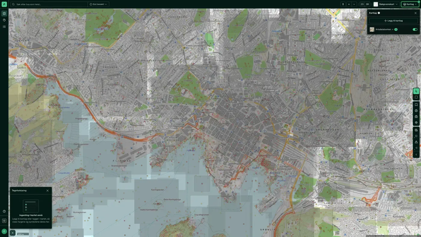
Kartverket is Norway's national mapping and land registration authority, and the single vendor most central to the core of Placepoint: property data. The agency runs the matrikkel (the official property register) and Grunnboken (the register of registered rights and encumbrances). It manages the national map and geodata services through Geonorge, and is the nautical chart authority responsible for depth data and coastlines.
What Kartverket gives you
Kartverket works closely with the municipalities through geosynchronisation of planning data. It supplies national copies of municipal zoning plans, municipal plans and building data from the Common Map Database (FKB). Placepoint mirrors these national copies in the map. You get a consistent view across all 357 municipalities in Norway, without using each municipality's own viewing service.
Kartverket was established in 1773 and is the oldest technical agency in Norway still in operation. Our tasks have changed in step with the digitalisation of society.
This text is based on the source documentation, synced 16 October 2026.
From source to map
Registers, maps and services as the vendor publishes them.
We collect from the source, not from a copy of a copy, as often as the source is updated.
Linked to cadastre number and Organization Number, quality-assured, with source and date on every field.
Map, property panel, reports, Placepoint API and MCP.
Why Kartverket in Placepoint
Matrikkel, Grunnboken and planning data sit alongside company data and risk on the same screen.
Around 240,000 registered changes of ownership come in every year. We mirror the changes continuously.
Zoning plans and municipal plans are synchronised from the municipalities. Placepoint shows the national copy.
Every dataset is labelled with its vendor and update frequency. You can order land register extracts directly from the platform.
Each dataset follows its source's update schedule, shown for that dataset. The category is the map layer group the dataset sits under in Fusion.
How to get started
We show you the data on properties you know.
Use an address, cadastre number or the map. The panel shows what is registered on the property.
The layers from this source are in the layer picker, sorted by category.
The Placepoint API and the MCP server give you the same data programmatically.
The matrikkel is the official register of properties, buildings and addresses. Grunnboken records registered rights and encumbrances. Kartverket manages both, and both are in Placepoint: matrikkel data appears directly in the panel and the map, and you order land register information under Document orders.
We mirror changes of ownership continuously from Kartverket's systems. The Recent transactions dataset covers the last 12 months and is updated daily.
The level of detail depends on what each municipality has made available nationally. Kartverket synchronises what the municipalities supply. Area purpose from municipal plans is available for the whole country.
Administrative boundaries are updated when the Storting approves changes. We handle changes to dataset structure in the normalisation layer, so map layers and the API keep the same format.
The table above shows how often each dataset is updated, which follows the source. Every field in Placepoint shows its source and date.
Yes. The Placepoint API exposes the same datasets programmatically, and the MCP server makes them available to AI agents. You can export extracts and reports from the platform.
More about the source
What customers say
“Placepoint is our main platform for property information. In practice, we only use Placepoint now.”
 Petter CedellGroup Director of Property Investments, Selvaag Bolig
“We see a clear efficiency gain with Placepoint, as much of the information we need on ownership, ownership structures, zoning purposes and encumbrances is gathered in one place. Several of us in the organisation use the tool daily and get a lot out of it.”
 Kristian AkslandPartner, CMS Kluge
“We use Placepoint daily for credit work. Among other things, we can identify ownership concentration in business parks.”
 Lars Kristian TveterSenior Relationship Manager, Danske Bank
“We have 25 salespeople using Placepoint every day to generate leads and find tenants.”
 Henning BjørnsgårdHead of Sales and Development, EIR
“We make active use of Placepoint in our nature-risk mapping. The data is an important part of what we base our decisions on.”
 Anne Cecilie OterkjærHead of Nature and Environment, OBOS
“Placepoint is simply our most important tool. It gives us instant access to site data, zoning and market insight that used to take days to dig up. When we assess new projects, Placepoint is the first thing we open.”
 Thomas BøCOO and partner, Bonum
“Placepoint provides property data that is an important input to our work. The quality and breadth of the data make a real difference day to day.”
 Marius DuffautHead of Property, Product Norway, If
“I use Placepoint almost daily and I'm very happy with it.”
 Svein Kristian PettersenBalsfjord kommune
“This program is worth its weight in gold.”
 Roger HenriksenHousing consultant, Bokvalitet
“Placepoint gives us a better basis for decisions early in the process, and makes it easier to identify opportunities and make the right choices.”
 Stian OlafsenHead of Projects and Development, Nordbohus
“Without Placepoint, we would have to go back to manual address lists. That would be a significant step backwards for our operations.”
 Camilla FredriksenHead of Diplom-Is-bilen Norge, Diplom-Is
“Intuitive, clear, quick response.”
 Tom Espen EideHead of Commercial Property, Skanska
“The best thing is the amount of information in one place, and the 3D view of the site with its surroundings and outlook.”
 Geir ØstevikArchitect and project developer, Mesterhus
“You can get an overview of the market. It feels like you're there in person.”
 Synne NappenAnalyst, Akershus Eiendom