









Phase 2 of 5: Develop
See what the plot can take before you draw.
A plot's development potential is set out in the zoning plans, and those plans are scattered across many sources. Here is what you need to check before you run the numbers on a plot.
Site assessment
One site assessment. A full working day, 40 minutes, or seven minutes.
Same seven steps, same clock. See who is done before the coffee goes cold.
Placepoint AI: Done 08:07. The rest of the day is yours.
The times without Placepoint are Placepoint's estimate for an experienced developer. The Placepoint AI time includes reading the answer. The plot and the answers are an example.
The times without Placepoint are Placepoint's estimate for an experienced developer. The Placepoint AI time includes reading the answer. The plot and the answers are an example.
Minutes per step
| Step | Without Placepoint | Placepoint Fusion | Placepoint AI |
|---|---|---|---|
| Owner and ownership chain | 30 min | 2 min | 0.5 min |
| Land register and transactions | 20 min | 2 min | 0.5 min |
| Municipal master plan and purpose | 45 min | 3 min | 0.5 min |
| Zoning plan and provisions | 2 h 30 min | 10 min | 2 min |
| Hazards and environment | 1 h | 5 min | 1 min |
| Neighbors and owners | 45 min | 3 min | 0.5 min |
| Memo | 1 h 30 min | 15 min | 2 min |
| Whole day | 7 h 20 min | 40 min | 7 min |
Used where decisions really matter







The questions that need answers
Before you develop: where to find the answers
Each question has one place in Placepoint where you find the answer, with the source shown.
Which plan applies, and what does it allow?
The Zoning tabThe municipal plan and zoning plans that cover the property, with purpose, plan id and a link to the plan document at the municipality. The plan can be drawn on the map with each vertical level shown separately.
Source: Municipal plan registers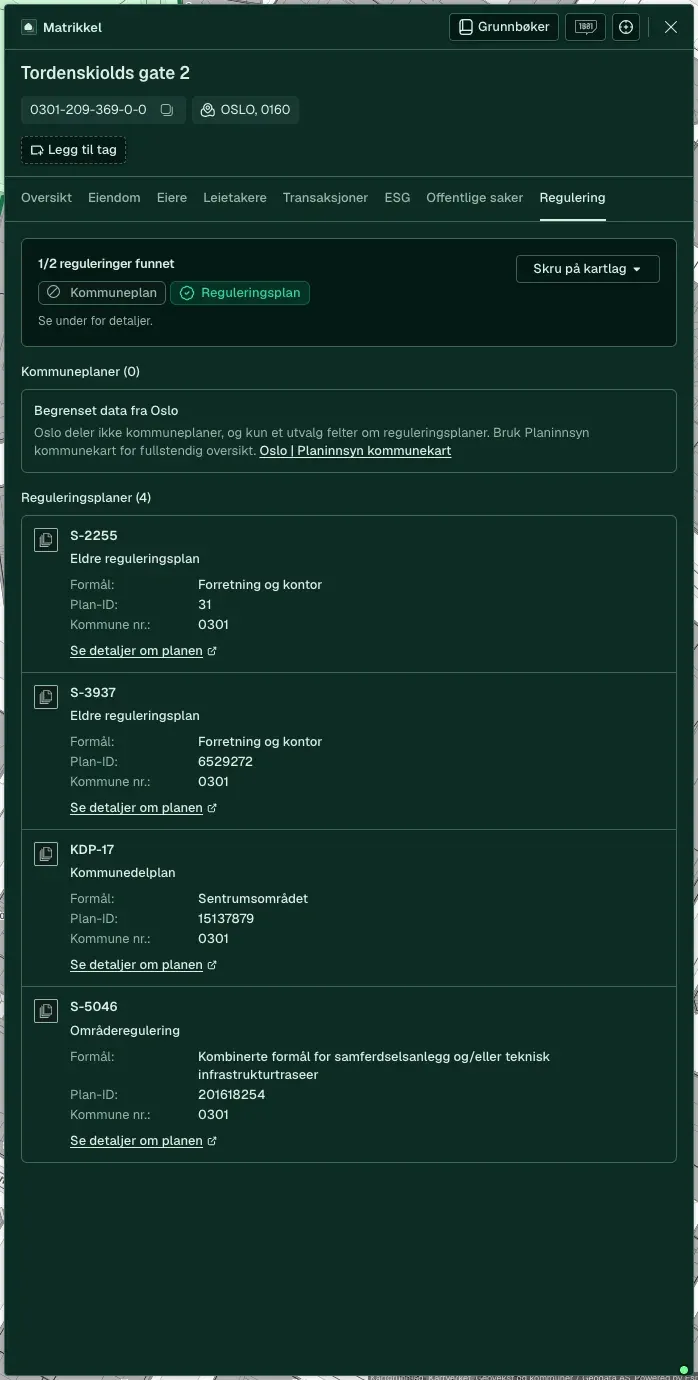
What sequencing requirements and consideration zones apply?
Map layers for zoning and consideration zonesConsideration zones appear as map layers over the plot, so you can see the constraints before you draw. The sequencing requirements are in the plan provisions, which the panel links to at the municipality.
Source: Municipal plan registers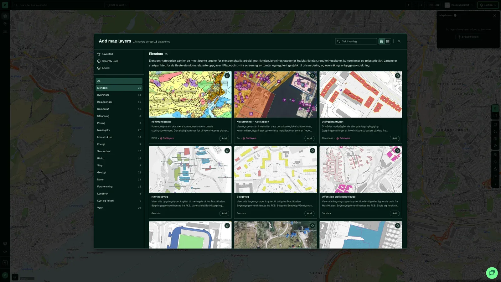
How much can you build, and how will it affect the neighbours?
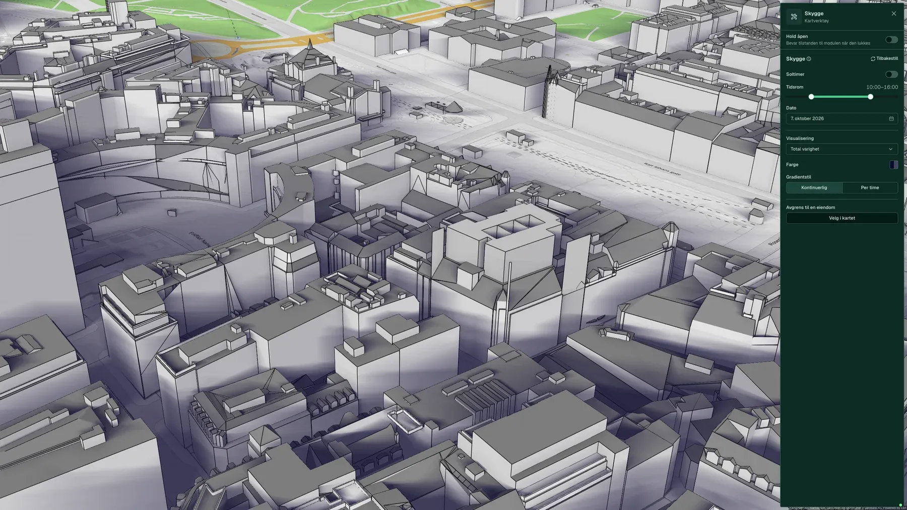
3D tool and Plot ValuationSee shadow and daylight hour by hour in 3D, and compare it with the utilization the plan allows.
Source: Building models from Kartverket and Placepoint calculations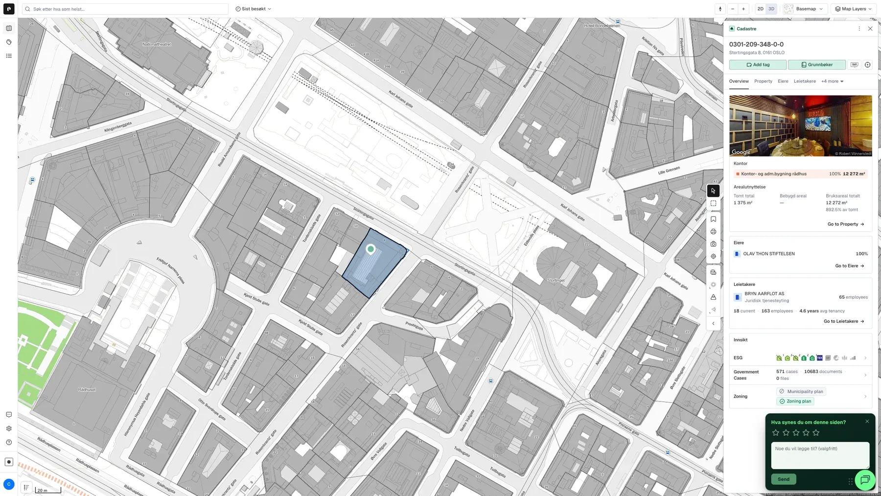
What do ground conditions, quick clay and flood risk mean for the plot?
The risk map layersQuick clay, landslide and flood risk layer by layer. The property panel marks the zones the plot actually falls within.
Source: NVE and NGU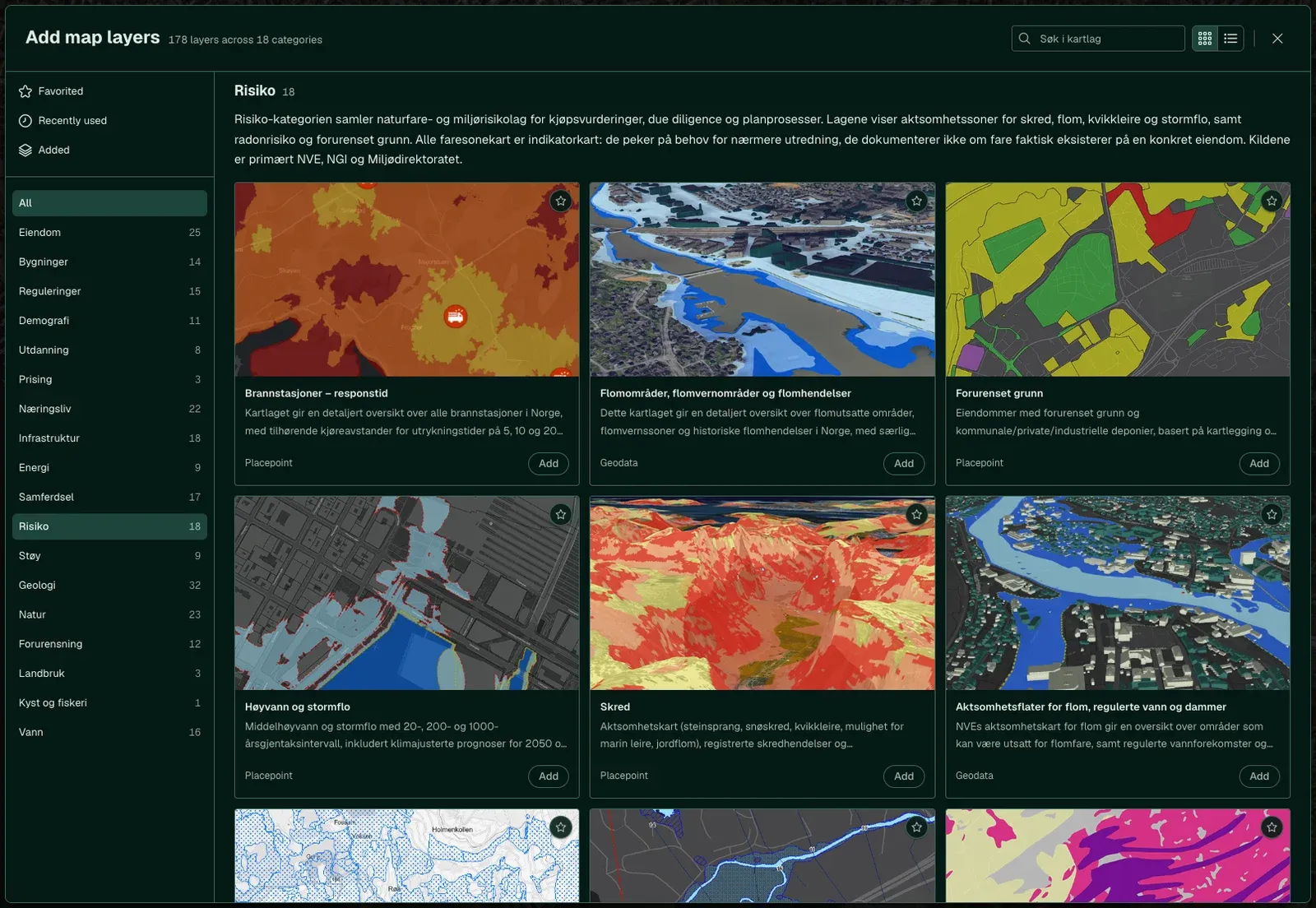
Which cases is the municipality processing in the area now?
Case recordsWe read the municipality's public records journals and link them to each property, so you can see what the neighbours have applied for and how the municipality has replied.
Source: Public records journals from over 330 municipalities, over 20 million documents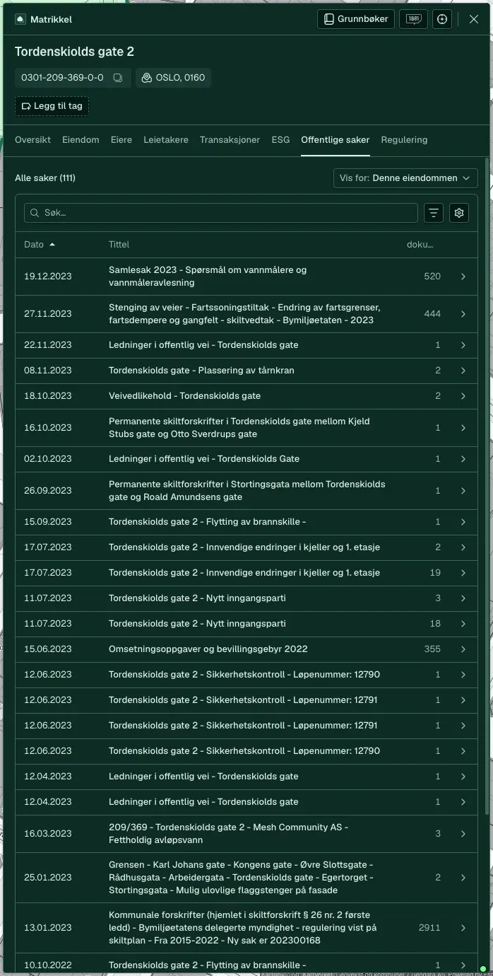
How to do it
From first search to development
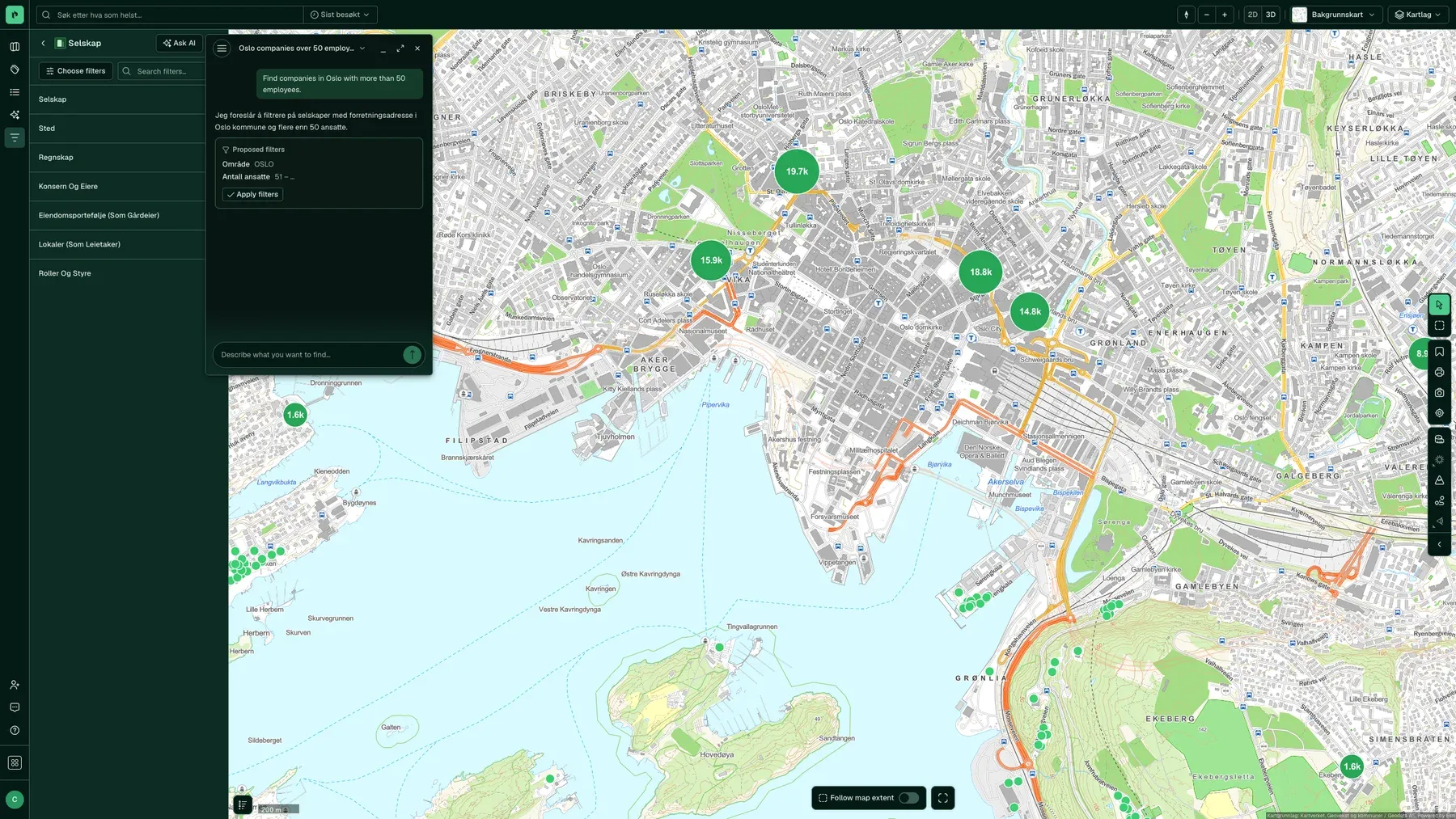
Five steps, as they look in Fusion. The screenshots show the feature, not the customer's own data.
- municipalities with public records journals in Saksinnsyn
- 330+
- Source: docs.placepoint.no/om/tall, retrieved 16 October 2026
- documents logged in the journals, linked to each property
- 20 million
- Source: docs.placepoint.no/om/tall, retrieved 16 October 2026
- map layers, including zoning, consideration zones and ground conditions
- 2,700
- Source: docs.placepoint.no/om/tall, retrieved 16 October 2026
The sources behind the answers
Zoning plans come from the municipalities, risk data from NVE and NGU, and buildings from Kartverket. Every layer shows its source and date.
Ask the Agent
The same answer in Claude, Copilot or ChatGPT
Placepoint AI gives your AI tool the same data as Fusion, with the source for each field. Three questions from this phase, and what you get back.
What is the plot zoned for, and which consideration zones affect it?
You getPurpose, utilization and consideration zones in plain language, with a link to the plan.
Find development plots in Bærum zoned for housing and larger than three mål (3,000 m²)
You getA list with owner, area and plan, ready to add as a filter in Fusion.
Which building applications have been submitted in the neighbourhood in the last twelve months?
You getThe cases for each address, with dates and the municipality's reply.
Examples. About Placepoint AI
What customers say
How they use it in this phase
“Placepoint is simply our most important tool. It gives us instant access to site data, zoning and market insight that used to take days to dig up. When we assess new projects, Placepoint is the first thing we open.”
 Thomas Bø, COO and Partner, Bonum
“Placepoint gives us a better basis for decisions early in the process, and makes it easier to identify opportunities and make the right choices.”
 Stian Olafsen, Head of Projects and Development, Nordbohus
Use cases
Use cases in this stage
Find the right property
Filter properties in Norway by what actually matters, instead of hunting for them.
Read MoreUnderstand a property
From one address to the full picture, without opening 20 sources.
Read MoreValue and potential
Your valuation rests on evidence you can document.
Read MoreRisk
All the risk map layers for the same property, in one lookup.
Read MoreLearn more
Terms you will come across in this phase
What is a zoning plan and what does it do?
The zoning plan controls what you can build and where. Learn about the plan map, provisions, planning description and area purpose, and the difference between area zoning and detailed zoning. A complete guide.
Read the articlePlanning and zoningMunicipality plan and zoning plan: which applies where?
What is the difference between a municipality plan and a zoning plan? We explain what you need to take into account.
Read the articlePlanning and zoningDevelopment agreements
What is a development agreement in property development? We explain the content, the parties and the process.
Read the articleProperty developmentPhases of property development
An overview of every phase of a property development project, from concept to completion.
Read the articleAcross the whole value chain