









The platform
Property data for Norway and Sweden, one foundation.
We collect, normalise, quality-check and connect data from public and private sources. You choose how the data reaches you: in a workspace, through an API or through an AI agent.
How it fits together
Sources in, one set of facts, three ways out.
We collect the registers, normalise them and combine them for each property. You then get the data on the map, in your own systems or in chat.
- The matrikkel
- Land Registry
- Zoning Plans
- Case records
- Transactions
- Energy labelling
- Tenants
- Business register
- Quick clay
- Demographics
- Public transport
- Cultural heritage
 Placepoint
- The matrikkel
- Land Registry
- Zoning Plans
- Case records
- Transactions
- Energy labelling
- Tenants
- Business register
- Quick clay
- Demographics
- Public transport
- Cultural heritage
PlacepointThree ways to use the data
The main choice is how the data reaches you
Placepoint Fusion
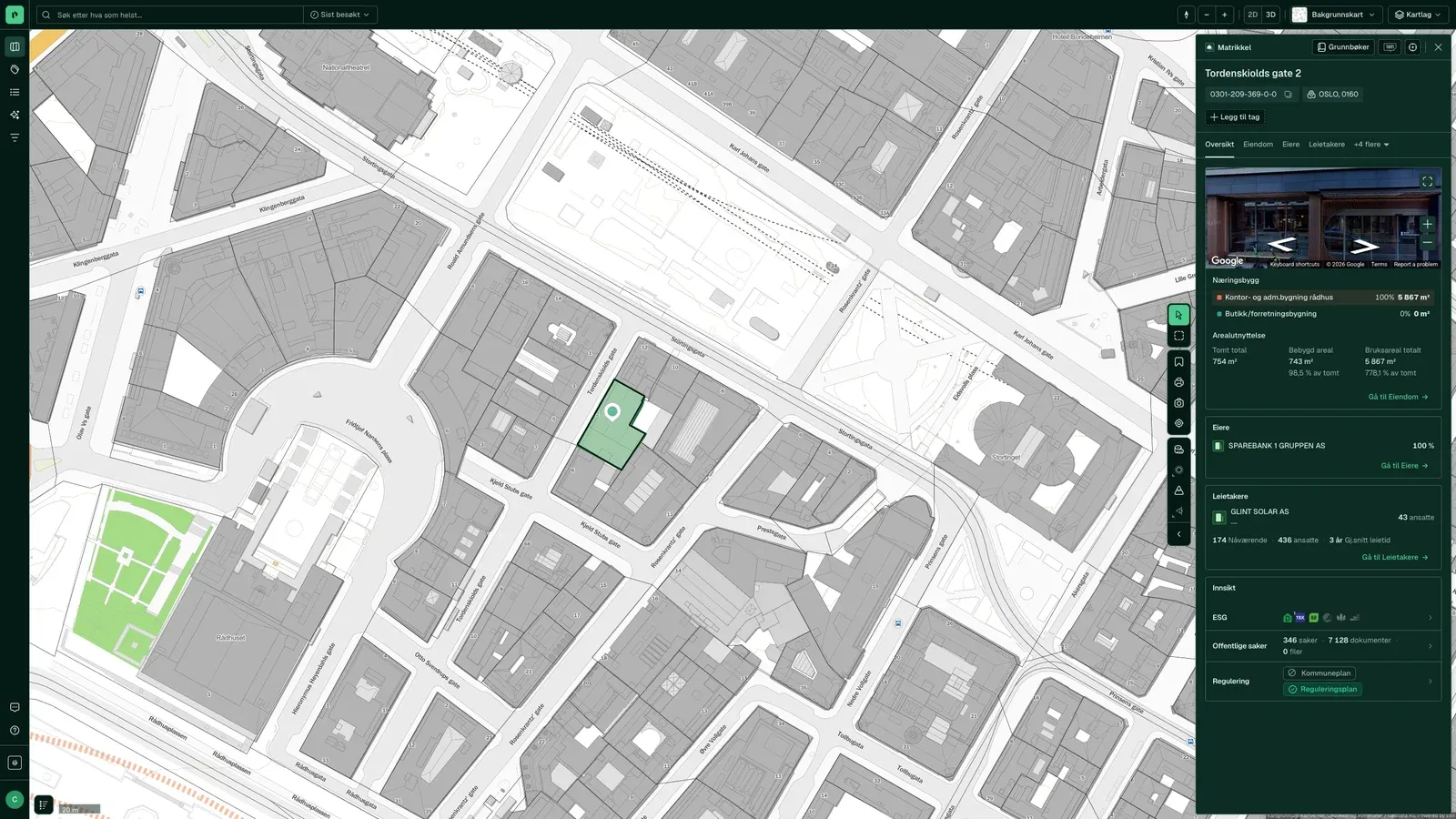
The workspace. Search, map, property panel, analyses and monitoring for anyone who looks up property.
About FusionEntrance 2Intelligence Factory
The programmatic route: Placepoint API, MCP for AI agents, and datasets delivered in your format.
About Intelligence FactoryBuilt on the platformPlacepoint Leads
Predictive tenant intelligence. Which companies are about to move, and where.
About LeadsWhichever way in you choose, the same data sits underneath. Start with one, or use all of them.
The data shapes the decision
Four things we do with the data before you see it
We collect
From the source: Kartverket, the municipalities, Brønnøysundregistrene, NVE, NGU, SSB and more.
We normalise
The same property is the same property across registers, by cadastre number and Organization Number.
We quality-assure
Every field shows its source and date, so you can see what you are relying on.
We connect
Owner, zoning, tenants, transactions and risk on the same card.
- matrikkelenheter (cadastral units) in Norway, with buildings, addresses and the land register
- 3.5 million
- Source: docs.placepoint.no/om/tall, retrieved 15 October 2026
- properties in Sweden, in all 290 municipalities
- 4.2 million
- Source: docs.placepoint.no/om/tall, retrieved 15 October 2026
- documents logged in the public records of over 330 municipalities
- 20 million+
- Source: docs.placepoint.no/om/tall, retrieved 15 October 2026
- sublayers from around 190 map services
- 2 500
- Source: docs.placepoint.no/om/tall, retrieved 15 October 2026
Across the whole value chain
From first site to daily operations
Who uses the platform
Same facts, your job
From site search to a fully zoned project
Developers make their living by seeing potential before others do. That means seeing zoning, ground conditions, ownership and neighbours for the same property, early enough to shape the decision to go ahead.
- Find plots that can take what you want to build
- Read zoning status and phasing requirements without calling the municipality
- Assess volume, sightlines and sunlight in 3D
- Map ground conditions, quick clay and flooding before you buy
- Find the registered owner and the right contact person
Property data straight into credit and risk models
Credit assessment of property needs fresh, quality-checked data in your own systems, not in a browser. Placepoint delivers property and risk data programmatically, priced by volume.
- Bring property and owner data straight into your credit model
- Assess collateral and security automatically
- Monitor your portfolio for changes in risk
- Document the basis for credit decisions
Faster from instruction to prospectus and buyer list
All three need data on who owns what, what has changed hands and who occupies the buildings around them. It is all in one search.
- Find potential sales instructions in an area
- Bring map extracts and area data straight into the sales particulars
- Price against comparable transactions
- Map likely buyers and what they already own
- Find tenants for vacant premises
The municipality's properties and cases on the same map
Municipalities and government bodies hold large property portfolios and make decisions that affect them every day. Placepoint brings planning documents, property data and public case records together in one place.
- Keep track of your own property portfolio
- See planning data and cases on the same map
- Find discrepancies between the register and reality
- Share evidence across departments
Safe to use
Norwegian company, data in the EU
- Hosted in the EU
- Data and operations within the EU.
- GDPR and data processing agreement
- Placepoint is the data controller. Data processing agreements with all third parties.
- Protected personal data
- Not shown, whatever the source.