









Map layers · 4 layers
Agriculture, layer by layer over the property.
The Agriculture category shows land classification (AR5), reindeer husbandry interests, arable land and aquaculture licences. The layers are useful for planning assessments in LNF areas (agriculture, nature and outdoor recreation zones). They also show whether a property is affected by farmland protection or reindeer husbandry rights, and help you assess the risk of formal objections in planning processes.
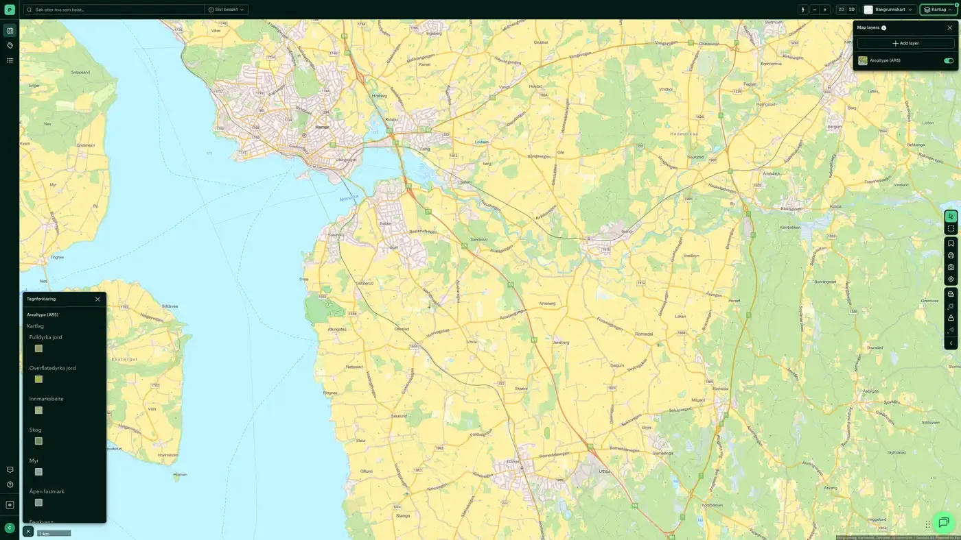
The layers
4 layers in agriculture
| Layer | Description | Source |
|---|---|---|
| Agriculture and fisheries buildings | Buildings registered under the agriculture and fisheries buildings code in the matrikkel | Kartverket |
| Reindeer husbandry | Reindeer husbandry areas in close to 140 kommuner, about 40% of Norway's area | Landbruksdirektoratet |
| Land cover types (AR5) | Main AR5 categories based on vegetation, natural drainage and cultural influence | Norsk institutt for bioøkonomi (NIBIO). Datasets: Land cover types (AR5) |
| Arable land | Areas that, through cultivation, can be brought up to fully cultivated land | Norsk institutt for bioøkonomi (NIBIO) |
Layer by layer
What each layer shows
Land cover types (AR5)
AR5 (land resource map at a scale of 1:5000) classifies Norwegian land by vegetation type, natural drainage and cultural influence. The five main categories are fully cultivated land, surface cultivated land, infield pasture, forest and open firm ground. The layer is supplied by Norsk institutt for bioøkonomi (NIBIO) and is used in planning assessments to identify cultivated land protected under the Land Act. Kommuner and the Statsforvalter (county governor) can raise a formal objection to development on fully cultivated and surface cultivated land. AR5 classification of land cover types (for example fully cultivated land, forest, bog, built-up, transport, fresh water, sea and glacier), used for land use planning and agricultural management. Includes information about forest site quality and the category "Not mapped".
Reindeer husbandry
Shows reindeer husbandry areas in close to 140 kommuner, equal to about 40% of Norway's land area. Reindeer husbandry is a legally protected right for Sami reindeer herders. Plans that affect grazing areas, migration routes or calving grounds can trigger a formal objection from the Statsforvalter. The dataset is managed by Landbruksdirektoratet. Datasets: Reindeer husbandry. Areas used by Sami reindeer husbandry through the seasons (spring, summer, autumn, winter). Advisory information for planning, infrastructure and land use conflicts.
Arable land
Shows areas that can be cultivated into fully cultivated land with reasonable effort. Arable land is a non-renewable resource and is subject to strict farmland protection policy. The kommune can require compensating measures when arable land is built on, and the Statsforvalter can raise a formal objection. Data is from Norsk institutt for bioøkonomi (NIBIO). Datasets: Arable land. Areas that, through cultivation, can be brought into a state that meets the requirements for fully cultivated land, based on AR5/DMK with annual updates.
The datasets behind
Datasets in agriculture
Land cover types (AR5)
The main classification in AR5, NIBIO's national land resource map, based on vegetation, natural drainage and human influence.
About the datasetArable land
Arable land is land that, if cultivated, can be brought up to the standard of fully cultivated land. It is a latent topsoil reserve that is not necessarily in active production today.
About the datasetReindeer husbandry
Geographical boundaries for reindeer husbandry in Norway, from the reindeer husbandry administration at Landbruksdirektoratet (the Norwegian Agriculture Agency).
About the datasetHow do I turn on the agriculture layers in Fusion?
Click Map layers at the top right of the map, select the category in the list on the left and turn on the layer. You can have several layers on at once, over the same property.
Where do the layers come from?
The sources are listed in the table above. They include Kartverket, Landbruksdirektoratet and Norsk institutt for bioøkonomi (NIBIO). Datasets: Land cover types (AR5), Norsk institutt for bioøkonomi (NIBIO). Each layer shows its source and date.
Can I get the same data programmatically?
Yes. The datasets behind the layers are available in the Placepoint API and in Placepoint AI through MCP.
Other categories
The layers and descriptions come from the documentation, synced 16 October 2026.
Used where decisions really matter







