









Map layers · 5 layers
Coast and fishing, layer by layer over the property.
Coast and fishing brings together three layers that show sea and lake depths and aquaculture permits in Norway. The category is useful when you assess coastal properties, plan cabin projects by the water or map marine use interests that can affect planning processes.
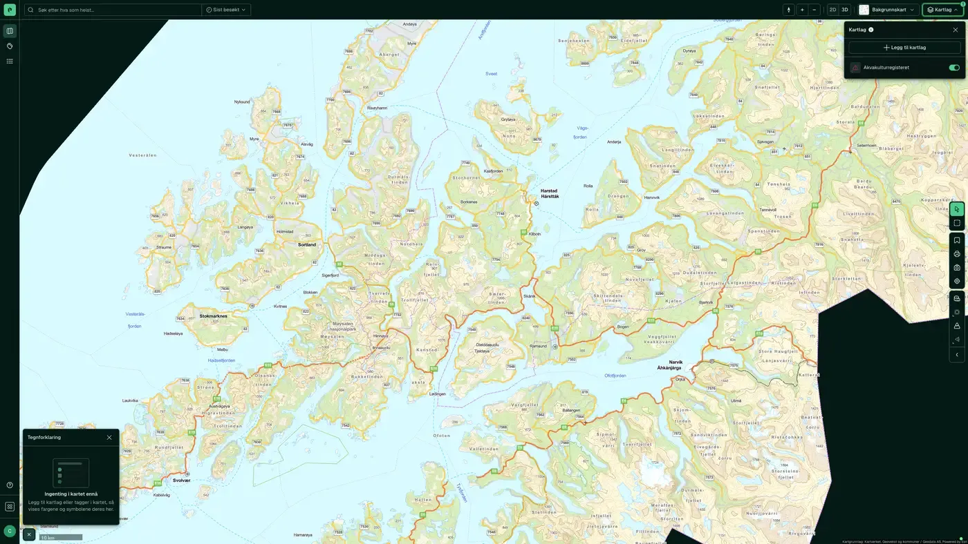
The layers
5 layers in Coast and fishing
| Layer | Description | Source |
|---|---|---|
| Agriculture and fisheries buildings | Shows all building types associated with agriculture and fisheries, from the matrikkel. | Kartverket |
| Shoreline management zone | Government planning guidelines for differentiated management of the shoreline zone along the sea (GeoNorge.no). | Kartverket |
| Aquaculture register | An overview of aquaculture permits and decisions. | Fiskeridirektoratet |
| Sea depth (bathymetry) | Coastline contour, constructed coast and skerries referenced to mean high water. The basis for Kartverket's nautical charts. | Kartverket |
| Lake depth (bathymetry) | The lake database, with hydrological information on Norwegian lakes. | Norges vassdrags- og energidirektorat (NVE). Datasets: Lake depth (bathymetry) |
Layer by layer
What each layer shows
Sea depth (bathymetry)
Coastline contour, constructed coast and skerries referenced to mean high water. The data forms the basis for Kartverket's official nautical charts and gives a visual picture of the coastline and depth-related constraints on development close to the sea. Useful for assessing access to a quay and mooring, shoreline zone clarifications and whether a property is affected by maritime legal rights. Coastline contour referenced to mean high water; depth points and contours following the Norwegian Armed Forces' navigation plan (for example 2, 5, 10 … 100, 150, 200 m). Basis for nautical products and coastal zone plans.
Lake depth (bathymetry)
The lake database of Norges vassdrags- og energidirektorat (NVE) with hydrological information about Norwegian lakes: area, volume, maximum and average depth. Relevant for cabin projects by water and for assessing intervention requirements under the Water Resources Act (vannressursloven). NVE's lake database (≥ 2,500 m²) with bathymetric contours where this data is available. Measurement method and accuracy vary.
Aquaculture register
Overview of aquaculture licences and decisions registered with Fiskeridirektoratet. Shows where licences have been granted for fish farms at sea. Relevant for mapping use interests that can set conditions for land use planning along the coast. The layer is also available under Water. Datasets: Aquaculture register. Licences and decisions for aquaculture sites, including location, species, capacity, biomass, escapes and environmental surveys.
The datasets behind
Datasets in coast and fishing
Aquaculture register
The Aquaculture register is the public register of all licences for aquaculture and fish farming in Norway, managed by Fiskeridirektoratet (the Directorate of Fisheries).
About the datasetLake depth (bathymetry)
NVE's lake database with hydrological information on all lakes and ponds in Norway larger than 2,500 m² (2.5 decares), a total of about
About the datasetSea depth (bathymetry)
Kartverket is the nautical charting authority in Norway, and this dataset is the official depth data for salt water. It is the basis for navigation products, coastal zone planning and property analysis in the coastal zone.
About the datasetHow do I turn on the coast and fishing layers in Fusion?
Click Map layers at the top right of the map, select the category in the list on the left and turn on the layer. You can have several layers on at once, over the same property.
Where do the layers come from?
The sources are listed in the table above. They include Kartverket, Fiskeridirektoratet and Norges vassdrags- og energidirektorat (NVE). Datasets: Lake depth (bathymetry). Each layer shows its source and date.
Can I get the same data programmatically?
Yes. The datasets behind the layers are available in the Placepoint API and in Placepoint AI through MCP.
Other categories
The layers and descriptions come from the documentation, synced 16 October 2026.
Used where decisions really matter







