









Datasets · Coast and fishing
Lake depth (bathymetry), linked to every property and ready to use.
NVE's lake database, with hydrological information on all lakes and ponds in Norway larger than 2,500 m² (2.5 decares): about 250,000 water bodies in total.
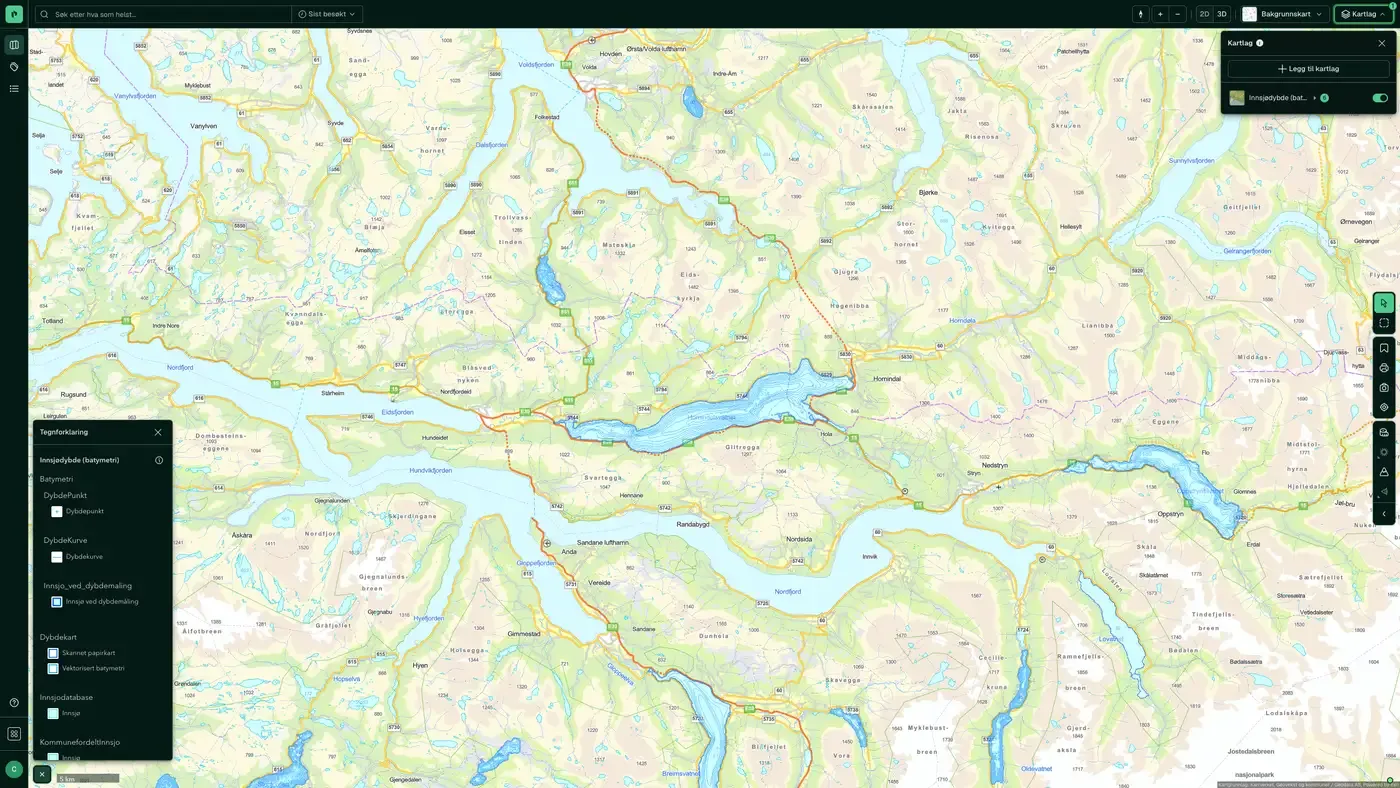
What the dataset contains
Lake depth (bathymetry) in Placepoint
NVE's lake database, with hydrological information on all lakes and ponds in Norway larger than 2,500 m² (2.5 decares): about 250,000 water bodies in total. The dataset is built on Kartverket's N50 map series and managed by the Norwegian Water Resources and Energy Directorate (NVE). Each lake has a national serial number that is used across NVE's systems to link it to other watercourse data.
Where bathymetry exists, the map also shows depth contours. Measurement method, resolution and accuracy vary widely: some larger lakes are mapped in high resolution, while smaller lakes often have only one or two depth points. For a developer, lake data is relevant for coastal property, watercourse regulation, drinking water abstraction, and planning jetties and crossings over water. For salt water and coastal depth, see Sea depth (bathymetry). It is part of Placepoint's map layers for water. Related: Watercourses and catchments, Water bodies.
This text is based on the dataset documentation, synced 16 October 2026.
More in the Coast and fishing map layer
Datasets often read together
Aquaculture register
The Aquaculture register is the public register of all licences for aquaculture and fish farming in Norway, managed by Fiskeridirektoratet (the Directorate of Fisheries).
About the datasetSea depth (bathymetry)
Kartverket is the nautical charting authority in Norway, and this dataset is the official depth data for salt water. It is the basis for navigation products, coastal zone planning and property analysis in the coastal zone.
About the datasetHow often is lake depth (bathymetry) updated?
Real time. The update frequency follows the source and is shown on the dataset in Placepoint.
Where does the data come from?
From Norges vassdrags- og energidirektorat. We collect and quality-check the data, then link it to the right property, with source and date on every field.
How do I see lake depth (bathymetry) for a property?
Look up the address in Fusion and turn on the Coast and fishing map layer. The dataset is a separate layer there, and the details appear in the property panel when you click on the map.
Can I get the dataset programmatically?
Yes. The same data is available in Placepoint API and in Placepoint AI through MCP, so you can bring it into your own systems and agents.
Used where decisions really matter







