









Datasets · Water
Watercourses and catchments, linked to every property and ready to use.
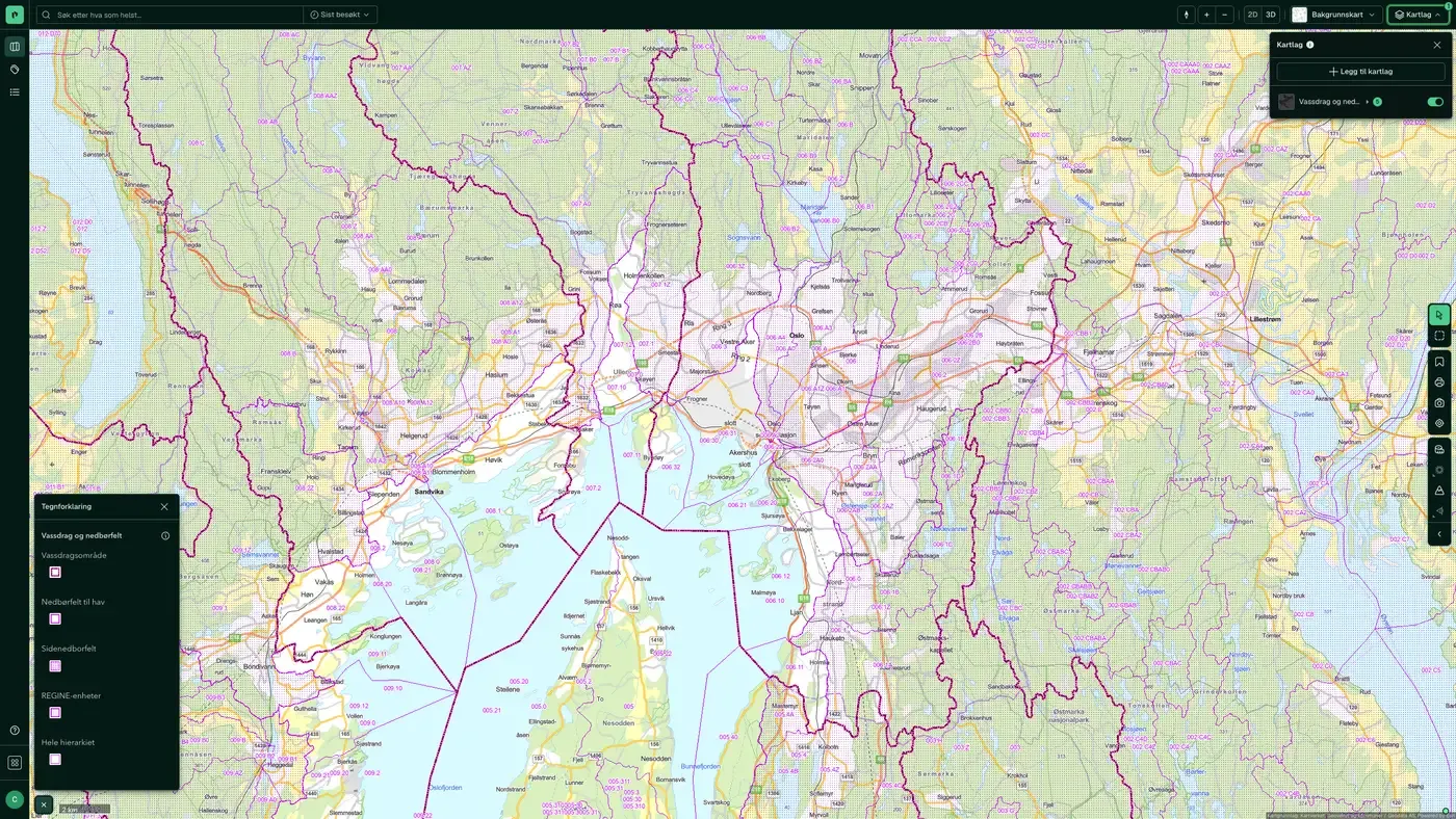
A watercourse is a connected system of rivers, streams, lakes and glaciers within a catchment area. It runs from its source in forest and mountains down to a shared outlet in the sea, a lake or a larger river. The dataset is REGINE, NVE's national hydrographic division of Norway's watercourses, built on Kartverket's N50 map series.
What the dataset contains
Watercourses and catchments in Placepoint
A watercourse is a connected system of rivers, streams, lakes and glaciers within a catchment area. It runs from its source in forest and mountains down to a shared outlet in the sea, a lake or a larger river. The dataset is REGINE, NVE's national hydrographic division of Norway's watercourses, built on Kartverket's N50 map series. REGINE defines catchments by three criteria: river channels longer than 10 km, catchments with lakes larger than 1 km², or areas that are regulated or planned for regulation (regardless of size). The dataset covers Norway's land and coastal area, including islands, and is managed by Norges vassdrags- og energidirektorat (NVE).
For developers and designers, catchment data is essential for flood calculations, licensing processes for hydropower and watercourse regulation, and environmental assessments where the water environment is a factor. Part of Placepoint's Water map layers. Related: Water bodies, Lake depth (bathymetry), Flood areas, flood protection areas, and flood events, Protected watercourses.
This text is based on the dataset documentation, synced 16 October 2026.
More in the Water map layer
Datasets often read together
Wastewater facilities
An overview of municipal wastewater facilities and discharge points, based on the Norwegian Environment Agency's specialist system Forurensning (Pollution) and collected through the municipalities' annual KOSTRA reporting.
About the datasetDrainage lines
Modelled water flow lines in the terrain. The lines show where water will collect on an area larger than one decare (1,000 m²). They are based on an analysis of the national terrain model at 50 cm resolution from hoydedata.no.
About the datasetRiver network
ELVIS, the national river network, from main rivers at overview level to the full network when you zoom in.
About the datasetSoil moisture
Modelled soil moisture map. It shows the vertical height difference in centimetres (registered as metres in the layer name) between each terrain point and the nearest point calculated to be water-saturated.
About the datasetWater bodies
Water bodies for both surface water and groundwater.
About the datasetProtected watercourses
Watercourses protected from hydropower development through Verneplan for vassdrag (the protection plan for watercourses), a legal designation adopted by the Storting over several decades.
About the datasetHow often are watercourses and catchments updated?
Real time. The update frequency follows the source and is shown on the dataset in Placepoint.
Where does the data come from?
From Norges vassdrags- og energidirektorat. We collect and quality-check the data, then link it to the right property, with source and date on every field.
How do I see watercourses and catchments for a property?
Look up the address in Fusion and turn on the Water map layer. The dataset is a separate layer there, and you see the details in the property panel when you click on the map.
Can I get the dataset programmatically?
Yes. The same data is available in Placepoint API and in Placepoint AI through MCP, so you can bring it into your own systems and agents.
Used where decisions really matter







