









Datasets
Flood areas, flood protection areas, and flood events, already linked to every property.
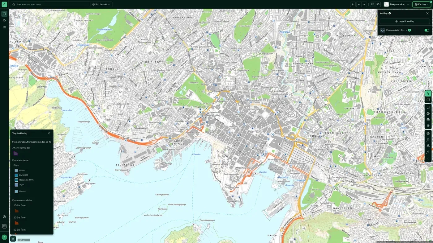
Detailed flood dataset for Norway based on NVE's flood zone mapping. The dataset shows exactly which areas flood and with what return period. The main focus is usually the 200-year flood, because the building regulations TEK17 require most buildings to be safe from a 200-year flood (safety class F2).
What the dataset contains
Flood areas, flood protection areas, and flood events in Placepoint
Detailed flood dataset for Norway based on NVE's flood zone mapping. The dataset shows exactly which areas flood and with what return period. The main focus is usually the 200-year flood, because the building regulations TEK17 require most buildings to be safe from a 200-year flood (safety class F2). The dataset also contains recorded historical flood events and flood protection zones. Distributed by Geodata AS, with Norges vassdrags- og energidirektorat (NVE) as data owner.
For a developer or designer, the flood zone map is an essential basis for zoning plans: plots inside the flood zone trigger requirements for a raised ground level, stormwater detention or other structural measures. Do not confuse this dataset with Caution surfaces, (regulated) water, dams, which is a coarser first assessment for areas NVE has not mapped in detail. Part of the Risk and Water map layers. Related: High water/storm surge, Watercourses and catchments.
This text is based on the dataset documentation, synced 16 October 2026.
How often are flood areas, flood protection areas, and flood events updated?
Monthly. The frequency follows the source and is shown on the dataset in Placepoint.
Where does the data come from?
From Geodata AS. We collect and quality-check the data and place it on the correct property, with source and date on every field.
How do I see flood areas, flood protection areas, and flood events on a property?
Look up the address in Fusion. The dataset is in the property panel for the property.
Can I get the dataset programmatically?
Yes. The same data is available in Placepoint API and in Placepoint AI through MCP, so you can bring it into your own systems and agents.
Used where decisions really matter







