









Datasets · Education
Primary Schools, already linked to every property.
All public and private primary and lower secondary schools in Norway, from Utdanningsdirektoratet's Nasjonalt skoleregister (NSR, the national school register). The dataset includes school type (public/private), year groups, pupil numbers, contact information and the link to the school catchment area.
What the dataset contains
Primary Schools in Placepoint
All public and private primary and lower secondary schools in Norway, from Utdanningsdirektoratet's Nasjonalt skoleregister (NSR, the national school register). The dataset includes school type (public/private), year groups, pupil numbers, contact information and the link to the school catchment area. Position accuracy may vary slightly for some schools. NSR is updated against the business and enterprise register at Brønnøysundregistrene and Grunnskolens Informasjonssystem (GSI), which records the situation as of 1 October each year and publishes at the end of December.
For a housing developer, closeness to a primary school is one of the most important single factors in how attractive housing is to families with children. Together with school catchment areas, it decides which school a child gets a place at. Capacity pressure in a school catchment area can trigger sequencing requirements in zoning plans to extend a school or build a new one before a commencement permit is granted. Part of Placepoint's map layers for Education. Related: School catchment areas, Kindergartens, Upper secondary schools, Catchment areas for schools in Bergen.
Follows NSR reporting in December.
This text is based on the dataset documentation, synced 16 October 2026.
What it looks like
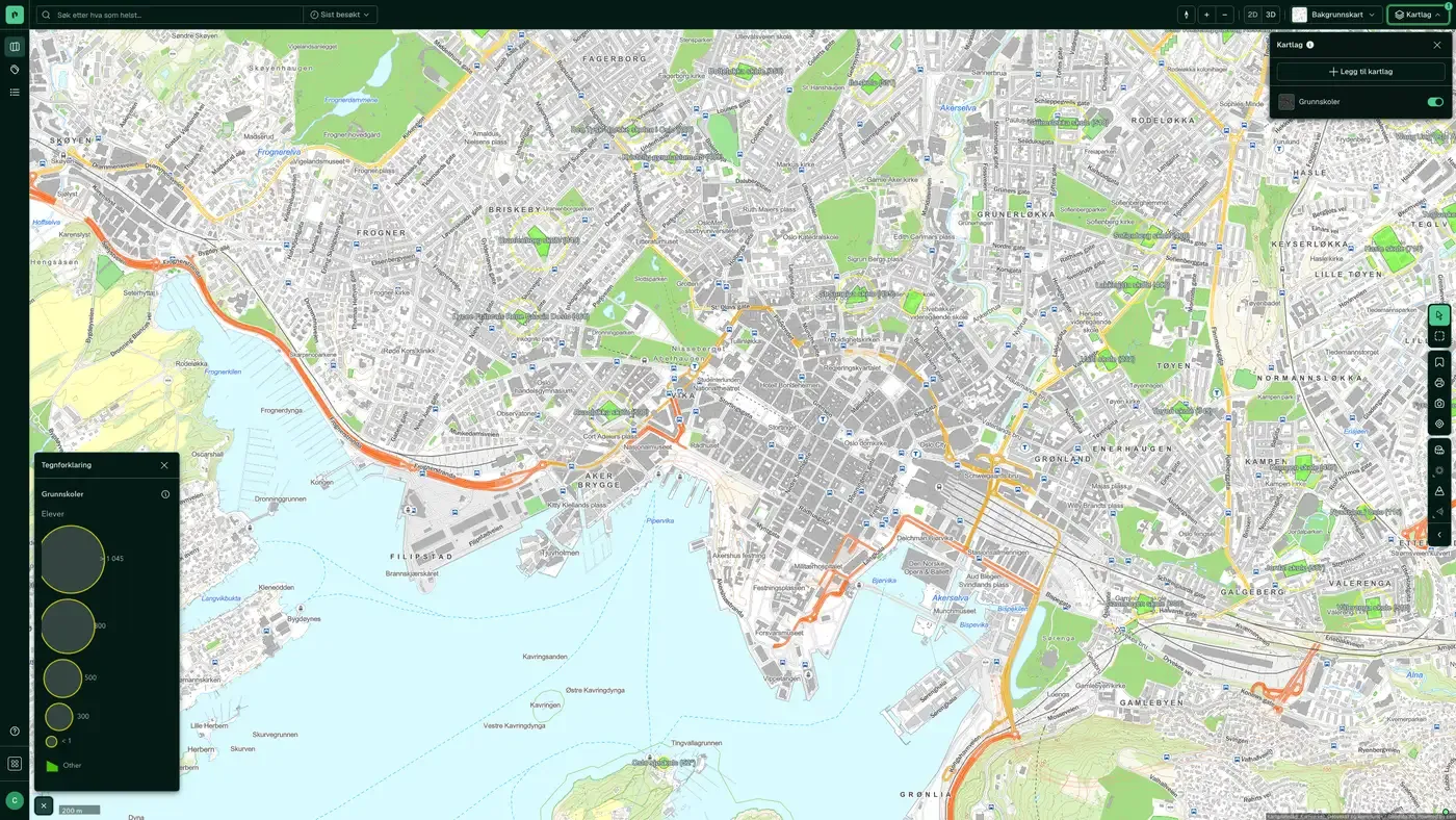
Primary Schools on the map
The dataset is part of the map layer Education:
More in the Education map layer
Datasets often read together
Kindergartens
All kindergartens in Norway from Barnehagefakta, the public kindergarten database run by Utdanningsdirektoratet (the Norwegian Directorate for Education and Training).
About the datasetSchool catchment areas
School catchment areas show which primary and lower secondary schools a specific home belongs to under the municipality's admission rules.
About the datasetUpper secondary schools
All public and private upper secondary schools in Norway from Nasjonalt skoleregister (NSR), run by Utdanningsdirektoratet, with contact information, ownership form, number of pupils and county.
About the datasetHow often are primary schools updated?
Annually. The frequency follows the source and is shown on the dataset in Placepoint.
Where does the data come from?
From Utdanningsdirektoratet. We collect the data, check its quality and place it on the right property, with source and date on every field.
How do I see primary schools on a property?
Look up the address in Fusion and turn on the Education map layer. The dataset is a separate layer there, and you see the details in the property panel when you click on the map.
Can I get the dataset programmatically?
Yes. The same data is available in Placepoint API and in Placepoint AI through MCP, so you can bring it into your own systems and agents.
Used where decisions really matter







