









Datasets · Business
Grocery Chains, already linked to every property.
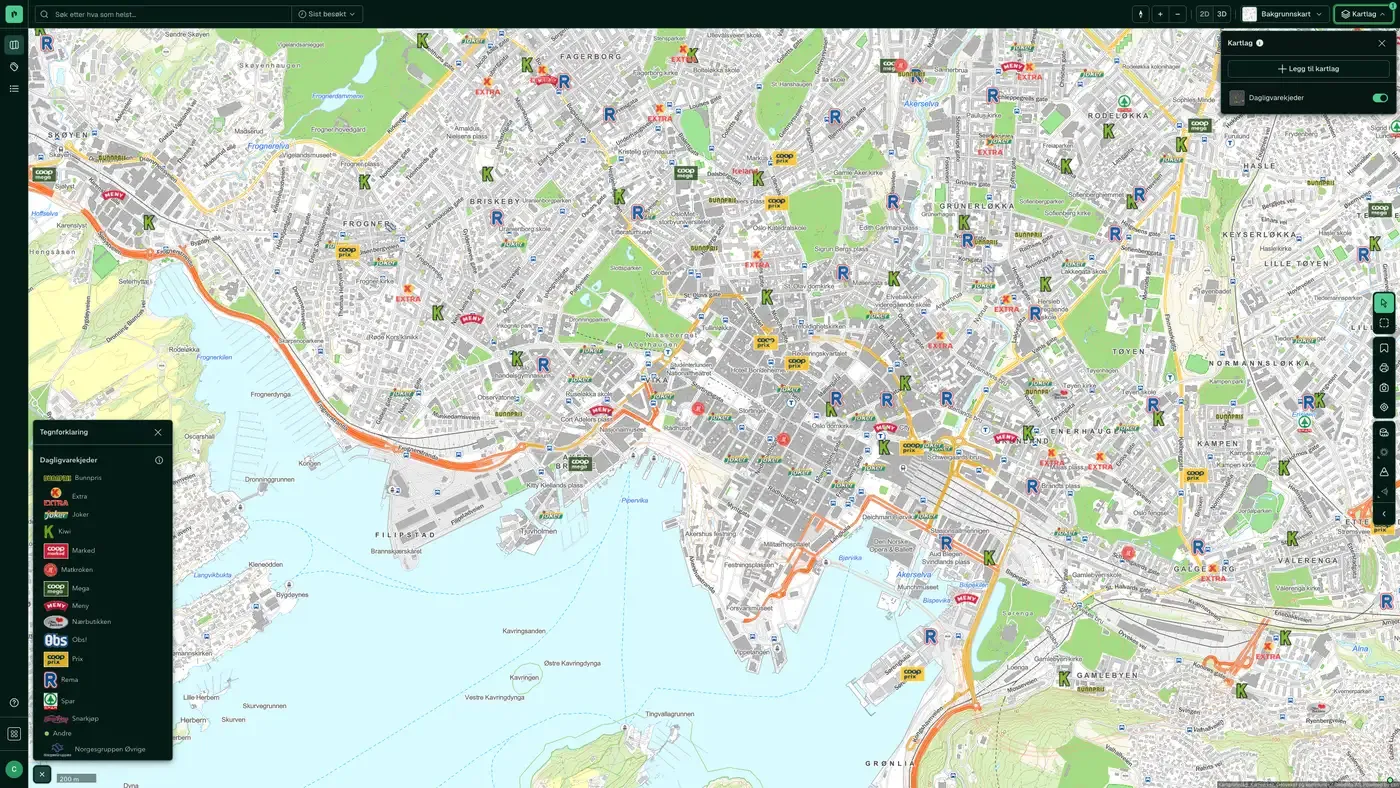
All grocery stores in Norway, including REMA 1000, Kiwi, Coop Extra/Mega/Prix, Meny, Spar, Joker and Bunnpris, with name, address, phone number, net revenue, operating profit and chain affiliation. The register is built on data from the chains themselves, supplemented with up-to-date information from Iper AS, and is supplied by Geodata AS.
What the dataset contains
Grocery Chains in Placepoint
All grocery stores in Norway, including REMA 1000, Kiwi, Coop Extra/Mega/Prix, Meny, Spar, Joker and Bunnpris, with name, address, phone number, net revenue, operating profit and chain affiliation. The register is built on data from the chains themselves, supplemented with up-to-date information from Iper AS, and is supplied by Geodata AS. The company information ultimately comes from the Central Coordinating Register for Legal Entities (Enhetsregisteret) at Brønnøysundregistrene.
As well as the store points, the dataset includes a heat map built on the same data: an interpolated density surface that shows where store coverage is high or low. The heat map is typically used in location analysis for new grocery stores, or to find underserved areas where new housing must take long shopping distances into account.
For a developer, the grocery map is one of the most important single indicators of how attractive an area is for housing and how retail is developing. For commercial agents, it is a basis for plot valuation when new grocery stores are planned (typically a plot of 3 to 8 decares with good access). Part of Placepoint's Business map layer. Related business locations based on BRREG: Department stores, Pharmacies, Fuel stations, Wine monopoly, Shopping centres.
This text is based on the dataset documentation, synced 16 October 2026.
What it looks like
Grocery Chains on the map
The dataset is part of the Naeringsliv map layer:
More in the Business map layer
Datasets often read together
Facilities register
The national register of sports facilities, cultural buildings and outdoor recreation facilities that have received or applied for gaming funds, managed by the Ministry of Culture and Equality (KUD).
About the datasetPharmacies
All pharmacies in Norway with chain affiliation (Apotek 1, Vitusapotek, Boots,...), industry codes, revenue, number of employees and operating profit.
About the datasetBuilding materials stores
All building materials stores in Norway, including chains such as Maxbo, Byggmakker, Coop Obs Bygg, Optimera/Montér and Bauhaus, with chain affiliation, industry codes, revenue, number of employees and operating profit.
About the datasetGrocery chains – heat map
Density map based on all grocery stores in Norway, useful for identifying areas with high or low coverage.
About the datasetReal Estate Transactions in the Media
Our derived overview of purchases and sales of property and property companies reported in the media. These are typically larger commercial property transactions and company sales covered by Estate Nyheter, DN Eiendom, E24, Finansavisen and similar publications.
About the datasetOwnership and Company Structure
Our compilation of businesses, their parent companies and NACE industry classification.
About the datasetHow often is the Grocery Chains dataset updated?
Weekly. The frequency follows the source and is shown on the dataset in Placepoint.
Where does the data come from?
From Geodata AS. We collect and quality-check the data and place it on the correct property, with source and date on every field.
How do I see Grocery Chains for a property?
Look up the address in Fusion and turn on the Business map layer. The dataset is a separate layer there, and the details appear in the property panel when you click on the map.
Can I get the dataset programmatically?
Yes. The same data is available in Placepoint API and in Placepoint AI through MCP, so you can bring it into your own systems and agents.
Used where decisions really matter







