









Datasets · Demographics
Field of education, already linked to every property.
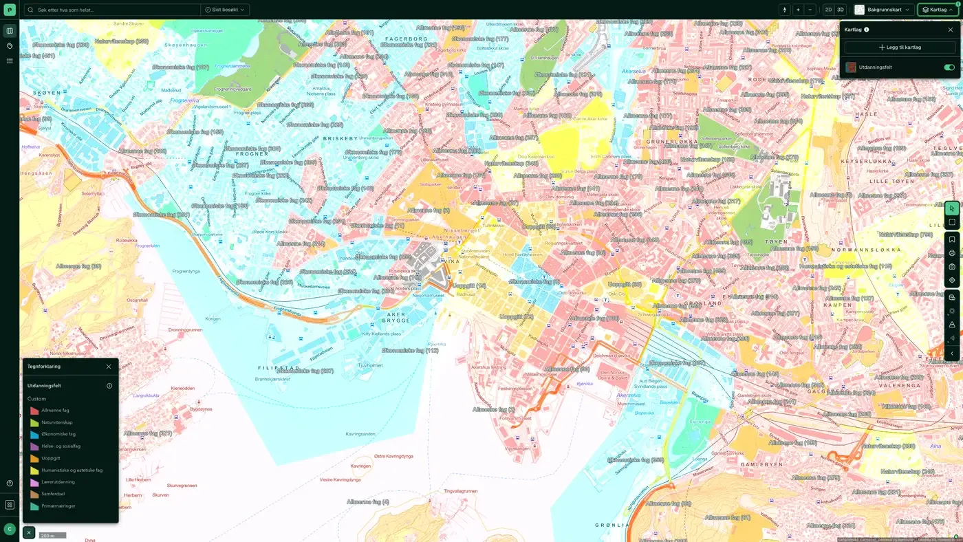
The main field of education per basic statistical unit: the subject category in which most people in the area have their education. The following categories are used: general programmes, health and social care, humanities and arts, teacher training, science, business and administration, primary industries, transport and communications, social sciences and not stated.
What the dataset contains
Field of education in Placepoint
The main field of education per basic statistical unit: the subject category in which most people in the area have their education. The following categories are used: general programmes, health and social care, humanities and arts, teacher training, science, business and administration, primary industries, transport and communications, social sciences and not stated. You can also get the number of people in each category. Geodata AS supplies the data to Placepoint, with Statistics Norway (SSB) as the data owner.
For a commercial agent, field of education signals which workforce is available in an area, which matters for office and commercial property. Areas with many people educated in health have a different profile from areas with many educated in business or science. Read it together with Education Level, Main Industry per Basic Statistical Unit, Income and Age distribution. Part of Placepoint's map layers for demographics and business.
This text is based on the dataset documentation, synced 16 October 2026.
What it looks like
Field of education on the map
The dataset is part of the Demographics map layer:
More in the Demographics map layer
Datasets often read together
Age distribution
Average age per basic statistical unit in Norway.
About the datasetPopulation
Population per basic statistical unit: the number of registered residents at the latest reference date.
About the datasetDaytime population
The number of people in each basic statistical unit during working hours, typically based on workplaces, schools and commuting.
About the datasetPopulation grid 100 m x 100 m
The map layer shows the number of residents in each cell of a 100 × 100 metre grid.
About the datasetWealth
Average net wealth per basic statistical unit, based on annual tax assessments from Skatteetaten (the Norwegian Tax Administration), compiled and published by Statistisk sentralbyrå (SSB) and distributed to Placepoint by Geodata AS.
About the datasetHouseholds
The number of households and their main composition per basic statistical unit, in five categories: single, no children; single, with children; multi-family; Couple, with children; and Couple, no children.
About the datasetHow often is field of education updated?
Annually. The frequency follows the source and is shown on the dataset in Placepoint.
Where does the data come from?
From Geodata AS. We collect and quality-check the data and place it on the correct property, with source and date on every field.
How do I see field of education for a property?
Look up the address in Fusion and turn on the Demographics map layer. The dataset is a separate layer there, and the details appear in the property panel when you click on the map.
Can I get the dataset programmatically?
Yes. The same data is available in Placepoint API and in Placepoint AI through MCP, so you can bring it into your own systems and agents.
Used where decisions really matter







