









Datasets
Mapped municipal plans, already linked to every property.
A selection of municipal plans and thematic plans that Placepoint has compiled by hand and published in a digital, searchable format. This gives users access to important plans that the nationwide Municipal plans copy from Kartverket does not cover. Today the dataset covers, among others:
What the dataset contains
Mapped municipal plans in Placepoint
A selection of municipal plans and thematic plans that Placepoint has compiled by hand and published in a digital, searchable format. This gives users access to important plans that the nationwide Municipal plans copy from Kartverket does not cover. Today the dataset covers, among others:
Bergen: Planning description for housing supply
Hamar: Town centre plan
Lillestrøm: Urban development plan and plot ratios
Oslo: Guiding plan for public space (VPOR) for Bjerke, Bryn, Frysja, Haraldrud, Hasle/Valle Hovin, Løren/Økern, Lysakerbyen, Mortensrud, Stovner/Rommen, Trosterud/Haugerud and Vollebekk
Oslo: Car-free city life (Bilfritt byliv)
For developers and property managers working in Oslo, Bergen, Lillestrøm and Hamar, these planning documents are strategically important. They set the framework for development on plots that would otherwise appear "fully zoned" in the standard planning data. Placepoint's data team adds to the dataset continuously as relevant thematic plans are published. Related: Zoning Plans, Municipal plans, Regulatory Plans (Oslo), Housing and area reserve (Oslo).
We map new plans continuously.
This text is based on the dataset documentation, synced 16 October 2026.
What it looks like
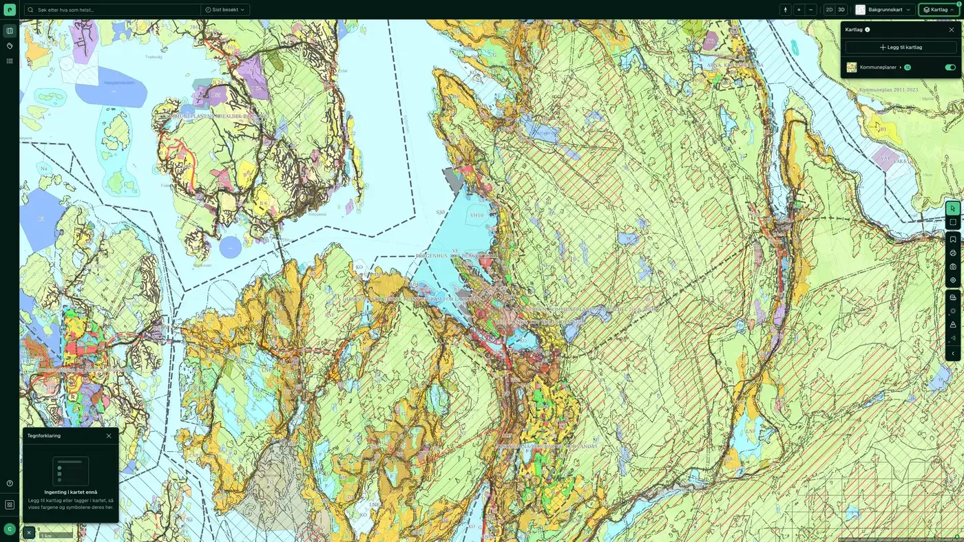
Mapped municipal plans on the map
The dataset appears in the Property map layer as part of the municipal plan layer:
How often are mapped municipal plans updated?
When the source changes. The frequency follows the source and is shown on the dataset in Placepoint.
Where does the data come from?
From Placepoint. We collect and quality-check the data, then link it to the right property, with the source and date on every field.
How do I see mapped municipal plans for a property?
Look up the address in Fusion. The dataset is in the property panel for the property.
Can I get the dataset programmatically?
Yes. The same data is available in Placepoint API and in Placepoint AI through MCP, so you can bring it into your own systems and agents.
Used where decisions really matter







