









Datasets · Transport and communications
Cars age, already linked to every property.
Average age of privately owned cars in an area, based on Statens vegvesen's motor vehicle register. The dataset is anonymised and suppressed so that individual car owners cannot be identified. Only aggregated figures per geographical cell are shown.
What the dataset contains
Cars age in Placepoint
Average age of privately owned cars in an area, based on Statens vegvesen's motor vehicle register. The dataset is anonymised and suppressed so that individual car owners cannot be identified. Only aggregated figures per geographical cell are shown. Geodata AS supplies it to Placepoint.
For commercial estate agents and valuers, car age can serve as a proxy for purchasing power and the area's socio-economic profile. A younger car fleet typically indicates higher disposable income or a younger population in a renewal phase. Read the dataset together with the related car fleet datasets: Cars and fuel types, Cars brands, Cars types and Electric cars. Part of Placepoint's Transport and communications and Demographics map layers.
This text is based on the dataset documentation, synced 16 October 2026.
What it looks like
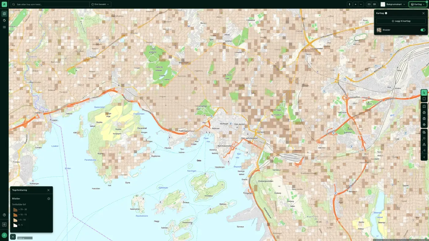
Cars age on the map
The dataset is part of the map layer Transport and communications:
More in the Transport and communications map layer
Datasets often read together
Cars and fuel types
Number of cars per fuel type in each area, based on Statens vegvesen's motor vehicle register.
About the datasetCars brands
Heat map of car density with the breakdown by car brand, based on Statens vegvesen's motor vehicle register.
About the datasetCars types
Number of cars per vehicle type in each area, based on Statens vegvesen's motor vehicle register.
About the datasetBuilding Limits from the Road's Center Line
The Roads Act sets general building limits measured from the centre line of all public roads. This legal boundary sets how close to the road you can build without a specific exemption.
About the datasetElectric cars
Number of privately owned electric cars per 100 x 100 m grid cell, taken from Statens vegvesen's motor vehicle register and anonymised and aggregated.
About the datasetPublic transport stops
Public transport stops for bus, metro, tram, train, ferry and port from Entur, the state-owned company that runs Norway's national hub for public transport data.
About the datasetHow often is cars age updated?
Weekly. The frequency follows the source and is shown on the dataset in Placepoint.
Where does the data come from?
From Geodata AS. We collect and quality-check the data and place it on the correct property, with source and date on every field.
How do I see cars age for a property?
Look up the address in Fusion and turn on the Transport and communications map layer. The dataset has its own layer, and the details appear in the property panel when you click on the map.
Can I get the dataset programmatically?
Yes. The same data is available in Placepoint API and in Placepoint AI through MCP, so you can bring it into your own systems and agents.
Used where decisions really matter







