









Datasets · Transport and communications
Building Limits from the Road's Center Line, already linked to every property.
The Roads Act sets general building limits from the road's centre line for all public roads. This legal limit sets how close to the road you can build without a specific exemption. The dataset comes from Statens vegvesen's Nasjonal vegdatabank (NVDB) and covers European roads, national roads, county roads and municipal roads.
What the dataset contains
Building Limits from the Road's Center Line in Placepoint
The Roads Act sets general building limits from the road's centre line for all public roads. This legal limit sets how close to the road you can build without a specific exemption. The dataset comes from Statens vegvesen's Nasjonal vegdatabank (NVDB) and covers European roads, national roads, county roads and municipal roads. It does not include private roads, and it does not reflect local zoning rules that override the Roads Act.
General building limits under the Roads Act, measured from the middle of the road:
European road: 100 metres
National road: 50 metres
County road: 50 metres
Municipal road: 15 metres
Footpath and cycle path: 15 metres
If a zoning plan or the provisions of the land-use part of the municipal master plan do not set the building limit, the general limits in the Roads Act apply. Tunnels are shown with a building limit even though they are underground, so you should filter them out. Statens vegvesen, the county authority or the municipality handles applications for exemption from the building limit.
For a developer, this dataset is one of the restrictions with the most practical effect in plot valuation near roads. It is part of our Transport and communications and Risk map layers. Related: Road category, authority & speed limit, Traffic volume.
This text is based on the dataset documentation, synced 16 October 2026.
What it looks like
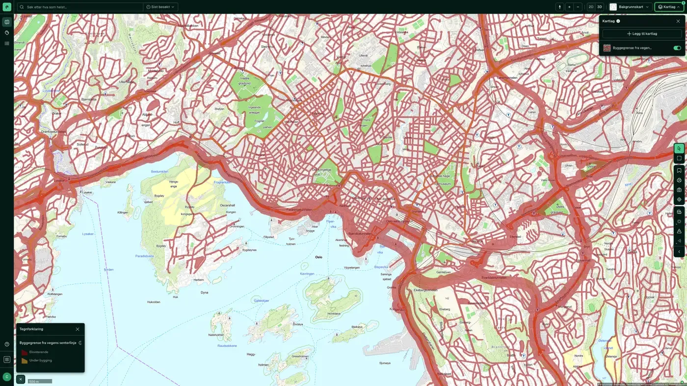
Building Limits from the Road's Center Line on the map
The dataset is part of the map layer Transport and communications:
More in the Transport and communications map layer
Datasets often read together
Cars age
Average age of privately owned cars in an area, based on Statens vegvesen's motor vehicle register.
About the datasetCars and fuel types
Number of cars per fuel type in each area, based on Statens vegvesen's motor vehicle register.
About the datasetCars brands
Heat map of car density with the breakdown by car brand, based on Statens vegvesen's motor vehicle register.
About the datasetCars types
Number of cars per vehicle type in each area, based on Statens vegvesen's motor vehicle register.
About the datasetElectric cars
Number of privately owned electric cars per 100 x 100 m grid cell, taken from Statens vegvesen's motor vehicle register and anonymised and aggregated.
About the datasetPublic transport stops
Public transport stops for bus, metro, tram, train, ferry and port from Entur, the state-owned company that runs Norway's national hub for public transport data.
About the datasetHow often is the Building Limits from the Road's Center Line dataset updated?
Monthly. The frequency follows the source and is shown on the dataset in Placepoint.
Where does the data come from?
From Statens vegvesen. We collect and quality-check the data, then link it to the right property, with source and date on every field.
How do I see Building Limits from the Road's Center Line on a property?
Look up the address in Fusion and turn on the Transport and communications map layer. The dataset has its own layer, and the details appear in the property panel when you click on the map.
Can I get the dataset programmatically?
Yes. The same data is available in Placepoint API and in Placepoint AI through MCP, so you can bring it into your own systems and agents.
Used where decisions really matter







