









Datasets
Substations, towers, poles & licences, already linked to every property.
Detailed individual installations from Statnett's Netbas system: all substations, power line towers, poles and licence data for the transmission grid and the upper distribution grid. The dataset is digitised mainly at a scale of 1:50,000 (some at 1:5,000, and some with precisely surveyed coordinates).
What the dataset contains
Substations, towers, poles & licences in Placepoint
Detailed individual installations from Statnett's Netbas system: all substations, power line towers, poles and licence data for the transmission grid and the upper distribution grid. The dataset is digitised mainly at a scale of 1:50,000 (some at 1:5,000, and some with precisely surveyed coordinates). Installations exempt from public access under section 13 of the Norwegian Freedom of Information Act (offentlighetsloven § 13) are not included. Distributed by the Norwegian Water Resources and Energy Directorate (NVE).
For a developer or designer, the individual installations matter in plot valuation near existing infrastructure. Being close to a substation can trigger noise and radiation assessments, and power line towers set limits on building distance under the rules on building restriction zones. Read the dataset together with Grid installations (the line network itself) and Planned Electrical Installations in the Power System (planned installations). Part of Placepoint's map layers for energy and infrastructure.
This text is based on the dataset documentation, synced 16 October 2026.
What it looks like
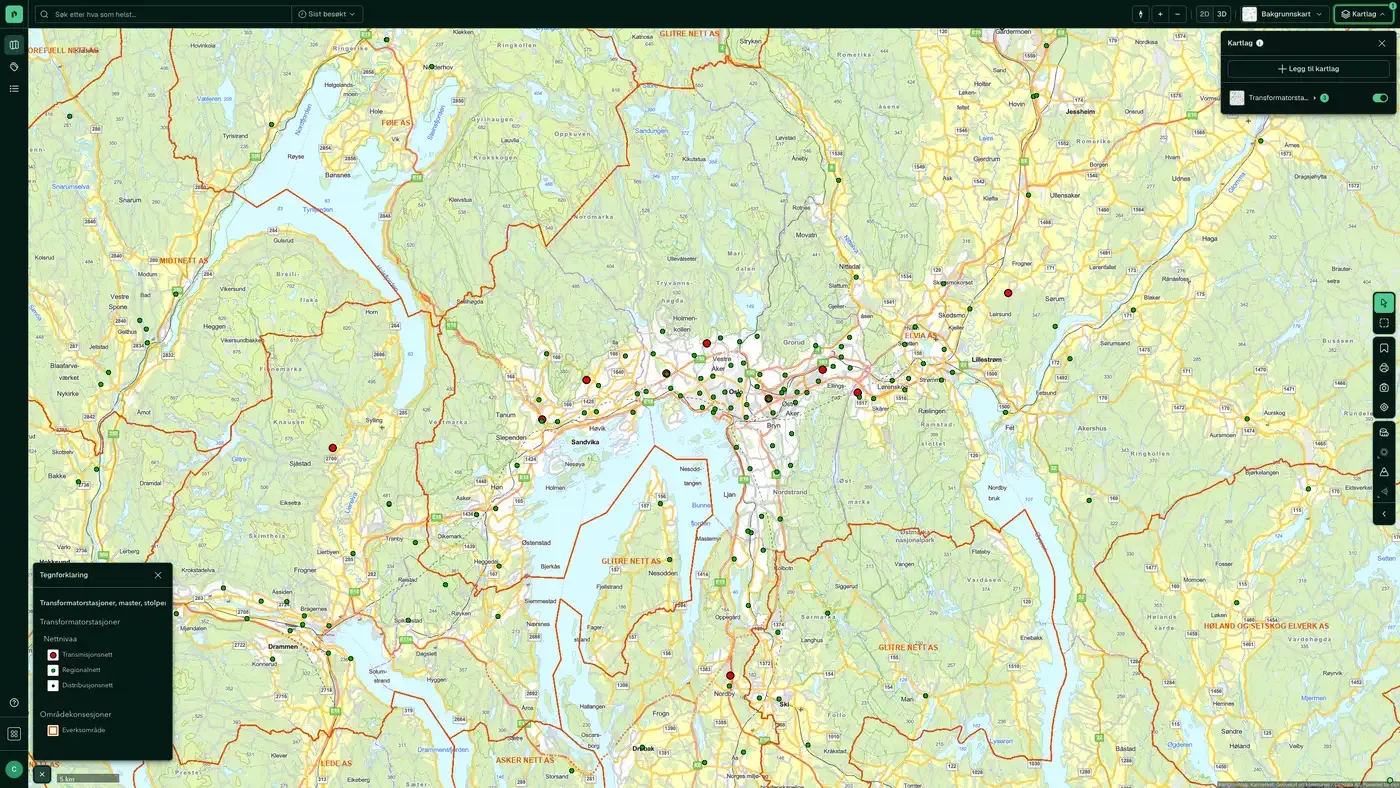
Substations, towers, poles & licences on the map
The dataset is part of the Energy and environment map layer:
Source: Netbas (Volue). Last updated 9 September 2026
How often are substations, towers, poles & licences updated?
Weekly. The frequency follows the source and is shown on the dataset in Placepoint.
Where does the data come from?
From Netbas and the Norwegian Water Resources and Energy Directorate. We collect the data, check its quality and place it on the correct property, with the source and date on every field.
How do I see substations, towers, poles & licences for a property?
Look up the address in Fusion. The dataset is in the property panel for the property.
Can I get the dataset programmatically?
Yes. The same data is available in Placepoint API and in Placepoint AI through MCP, so you can bring it into your own systems and agents.
Used where decisions really matter







