









Datasets · Pollution
Noise mapping (T-1442), already linked to every property.
Noise warning maps under Guideline T-1442, the official guidance on handling noise in land-use planning. Geodata AS supplies the dataset to Placepoint. It is mainly based on the NorStøy model from Statens vegvesen (the Norwegian Public Roads Administration), using Nord2000Road as the calculation method.
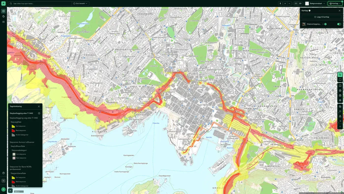
What the dataset contains
Noise mapping (T-1442) in Placepoint
Noise warning maps under Guideline T-1442, the official guidance on handling noise in land-use planning. Geodata AS supplies the dataset to Placepoint. It is mainly based on the NorStøy model from Statens vegvesen (the Norwegian Public Roads Administration), using Nord2000Road as the calculation method.
The map layer shows two key noise zones along national and county roads:
Red zone: Lden above 65 dB (above the limit values; building here requires special measures)
Yellow zone: Lden above 55 dB (triggers a requirement for assessment and typically facade insulation for new buildings)
The calculations show a forecast situation 15 to 20 years ahead, with traffic volume (ÅDT, annual average daily traffic) projected from forecasts. The calculation height is 4 metres above ground. Traffic data comes from the National Road Database (NVDB), base map data from the Common Map Database (FKB), and building information from the matrikkel.
For a developer, the T-1442 layer is a required check at the zoning stage: building inside the yellow or red zone triggers a requirement for a noise assessment and mitigation measures. Part of Placepoint's Noise map layers. Related: Road noise, Rail/metro/tram noise, Traffic volume.
This text is based on the dataset documentation, synced 16 October 2026.
More in the Pollution map layer
Datasets often read together
Contaminated land
Properties registered with contaminated land, and municipal and private/industrial landfills.
About the datasetSoil Contamination – Areas
The service covers properties with contaminated land and municipal and private/industrial landfills.
About the datasetRail/metro/tram noise
Calculated average noise from railways (including metro and tram) at 4 metres above ground.
About the datasetRoad noise
Calculated average road traffic noise at 4 metres above ground, from roads with at least 3 million vehicle passes per year (AADT 8,200+).
About the datasetHow often is Noise mapping (T-1442) updated?
Weekly. The frequency follows the source and is shown on the dataset in Placepoint.
Where does the data come from?
From Geodata AS. We collect and quality-check the data and place it on the correct property, with source and date on every field.
How do I see Noise mapping (T-1442) for a property?
Look up the address in Fusion and turn on the Pollution map layer. The dataset is there as a separate layer, and the details appear in the property panel when you click on the map.
Can I get the dataset programmatically?
Yes. The same data is available in Placepoint API and in Placepoint AI through MCP, so you can bring it into your own systems and agents.
Used where decisions really matter







