









Datasets · Nature
NiN mapping units, linked to every property.
Nature areas mapped under Natur i Norge (NiN), the standardised system from Artsdatabanken (the species database) for classifying and describing Norwegian nature. The Norwegian Environment Agency (Miljødirektoratet) supplies the dataset at scales of 1:5,000 and 1:20,000. It includes all nature areas mapped under NiN Version 2 from 2015 onwards, plus converted data from NiN version 1 (2011 to 2014).
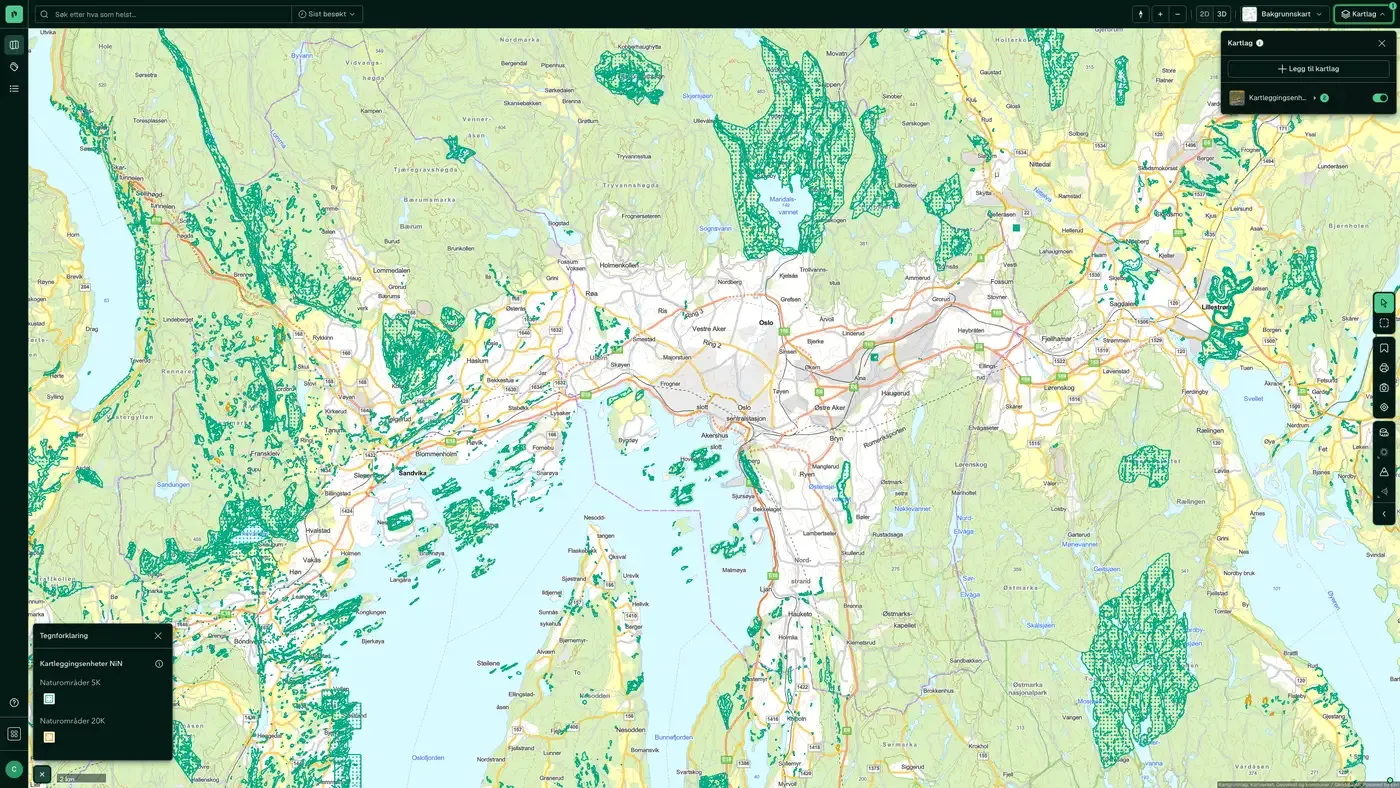
What the dataset contains
NiN mapping units in Placepoint
Nature areas mapped under Natur i Norge (NiN), the standardised system from Artsdatabanken (the species database) for classifying and describing Norwegian nature. The Norwegian Environment Agency (Miljødirektoratet) supplies the dataset at scales of 1:5,000 and 1:20,000. It includes all nature areas mapped under NiN Version 2 from 2015 onwards, plus converted data from NiN version 1 (2011 to 2014).
Mapping is organised in projects and uses a dedicated field tool (NiNapp for iOS) that syncs continuously with a central database. When a mapper has submitted their data, the project moves to technical and professional approval by Miljødirektoratet before it is published.
For developers, NiN data is often a necessary basis for impact assessments for larger projects. A site with vulnerable nature types typically triggers consideration zones and mitigation requirements in zoning plans under the Nature Diversity Act (naturmangfoldloven). Part of Placepoint's map layers for nature. Related: Nature and cultural areas, Species of national management interest, Sensitive Species Data, The species database.
This text is based on the dataset documentation, synced 16 October 2026.
More in the Nature map layer
Datasets often read together
Species of national management interest
Species of national management interest is a management dataset of species that have some form of national status: threatened species (Red List), responsibility species (Norway has a particular management responsibility for them), protected species and invasive alien species.
About the datasetThe species database
Species observations and Red List assessments from Artsdatabanken, Norway's national knowledge bank for biodiversity.
About the datasetLarge carnivore management zones
Miljødirektoratet's boundaries for the management areas for bear, Eurasian lynx, wolverine and wolf.
About the datasetOutdoor recreation in protected areas
Protected areas that are also registered as outdoor recreation areas, with protection type and management authority.
About the datasetGrey areas
A national map of grey areas: land that is already in use or heavily affected by building and construction, including buildings, structures and permanent surfaces.
About the datasetOutdoor recreation areas
Areas mapped and valued using the method in Miljødirektoratet's guide M98-2013 "Kartlegging og verdsetting av friluftslivsområder" (mapping and valuing outdoor recreation areas).
About the datasetHow often are NiN mapping units updated?
Real time. The update frequency follows the source and is shown on the dataset in Placepoint.
Where does the data come from?
From Miljødirektoratet. We collect the data, check its quality and link it to the correct property, with the source and date on every field.
How do I see NiN mapping units on a property?
Look up the address in Fusion and turn on the Nature map layer. The dataset is a separate layer there. Click on the map to see the details in the property panel.
Can I get the dataset programmatically?
Yes. The same data is available in Placepoint API and in Placepoint AI through MCP, so you can bring it into your own systems and agents.
Used where decisions really matter







