









Datasets · Noise
Noise Map – Rail, already linked to every property.
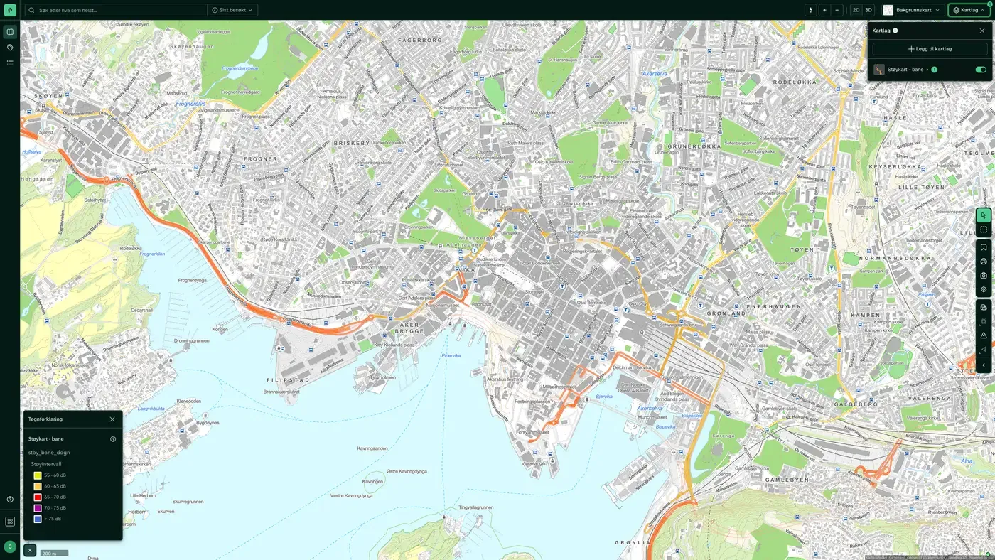
Average 24-hour noise from railways at 4 metres above ground, modelled (not measured). The maps show the situation in 2016.
What the dataset contains
Noise Map – Rail in Placepoint
Average 24-hour noise from railways at 4 metres above ground, modelled (not measured). The maps show the situation in 2016. Not for use in land use planning. Source: Miljødirektoratet (Norwegian Environment Agency). Part of Placepoint's Noise map layers.
This text is based on the dataset documentation, synced 16 October 2026.
What it looks like
Noise Map – Rail on the map
The dataset is part of the Noise map layers. You will find the screenshot, sublayers and what a click on the map shows under Noise Map – Rail.
Update frequency: When the source changes. Last updated 9 September 2026
More in the Noise map layers
Datasets often read together
Noise Map – Rail (Night)
Average night-time noise from railways at 4 metres above ground, modelled (not measured).
About the datasetNoise Map – Rail – Metropolitan
Average 24-hour noise from railways at 4 metres above ground, modelled (not measured), for the metropolitan areas of Oslo, Bergen, Trondheim, Stavanger, Sarpsborg and Fredrikstad.
About the datasetNoise Map – Rail – Metropolitan (Night)
Average night-time noise from railways at 4 metres above ground, modelled (not measured), for Oslo, Bergen, Trondheim, Stavanger, Sarpsborg and Fredrikstad.
About the datasetNoise Map – Road – Metropolitan
Average 24-hour noise from road traffic at 4 metres above ground, modelled (not measured), for the major cities of Oslo, Bergen, Trondheim, Stavanger, Sarpsborg and Fredrikstad.
About the datasetNoise Map – Road – Metropolitan (Night)
Average night-time noise from road traffic at 4 metres above ground, modelled (not measured), for Oslo, Bergen, Trondheim, Stavanger, Sarpsborg and Fredrikstad.
About the datasetHow often is Noise Map – Rail updated?
When the source changes. The frequency follows the source and is shown on the dataset in Placepoint.
Where does the data come from?
From Miljødirektoratet. We collect the data, check its quality and link it to the correct property, with the source and date on every field.
How do I see Noise Map – Rail on a property?
Look up the address in Fusion and turn on the Noise map layers. The dataset appears as a separate layer, and the property panel shows the details when you click on the map.
Can I get the dataset programmatically?
Yes. The same data is available in Placepoint API and in Placepoint AI through MCP, so you can bring it into your own systems and agents.
Used where decisions really matter







