









Datasets
Petroleum Infrastructure, already linked to every property.
Petroleum facilities and pipelines in Norway: processing plants, gas pipeline systems, landing facilities and hubs for the oil and gas industry. The dataset is supplied by Geodata AS, with Sokkeldirektoratet (formerly Oljedirektoratet) as the underlying data owner.
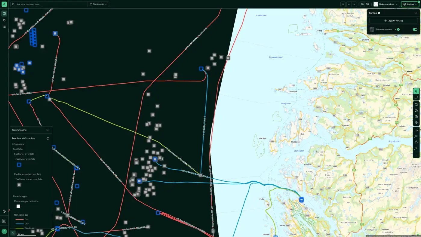
What the dataset contains
Petroleum Infrastructure in Placepoint
Petroleum facilities and pipelines in Norway: processing plants, gas pipeline systems, landing facilities and hubs for the oil and gas industry. The dataset is supplied by Geodata AS, with Sokkeldirektoratet (formerly Oljedirektoratet) as the underlying data owner.
For a property developer in petroleum regions (Stavanger, Bergen, Mongstad, Kollsnes, Mosjøen and others), proximity to petroleum facilities is both a factor in the local industry structure and a location factor: the facilities trigger safety zones that restrict land use nearby. For residential developers, proximity to large gas pipelines can trigger consideration zones in zoning plans. Part of our energy and infrastructure map layers. Related: Petroleum Wellbores, Petroleum Cultural, Grid installations.
This text is based on the dataset documentation, synced 16 October 2026.
How often is petroleum infrastructure updated?
Monthly. The frequency follows the source and is shown on the dataset in Placepoint.
Where does the data come from?
From Geodata AS and Sokkeldirektoratet. We collect and quality-check the data and place it on the correct property, with source and date on every field.
How do I see petroleum infrastructure on a property?
Look up the address in Fusion. The dataset is in the property panel for the property.
Can I get the dataset programmatically?
Yes. The same data is available in Placepoint API and in Placepoint AI through MCP, so you can bring it into your own systems and agents.
Used where decisions really matter







