









Datasets · Geology
Groundwater boreholes, already linked to every property.
Nationwide overview of drilled groundwater wells, energy wells and natural groundwater springs. The dataset takes its base information from NGU's GRANADA database, and Geodata AS distributes it to Placepoint.
What the dataset contains
Groundwater boreholes in Placepoint
Nationwide overview of drilled groundwater wells, energy wells and natural groundwater springs. The dataset takes its base information from NGU's GRANADA database, and Geodata AS distributes it to Placepoint.
Energy wells are a fast-growing category: rock-source heating is an attractive energy solution for new buildings, especially in central areas with strict emission requirements. For a developer, it is also useful to know where existing drinking water wells are, as new development in a catchment area may require consideration zones. Part of Placepoint's map layers for Water, Energy and Geology. Related: Groundwater (GRANADA) (full database), NADAG – ground investigations, Bedrock.
This text is based on the dataset documentation, synced 16 October 2026.
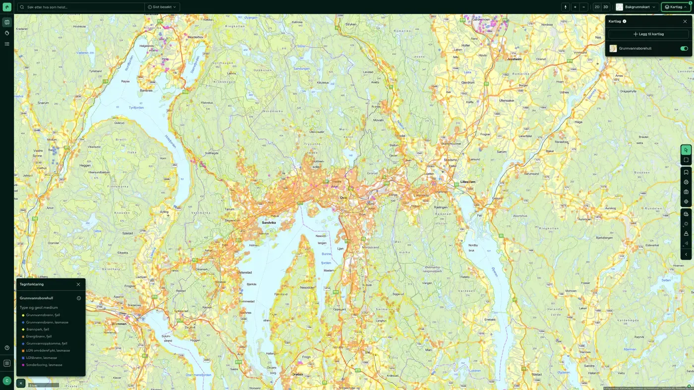
What it looks like
Groundwater boreholes on the map
The dataset is part of the map layer Geology:
More in the Geology map layer
Datasets often read together
Bedrock, derived maps, NiN
Derived bedrock maps from NGU for Natur i Norge: forecast for lime content in the bedrock and the extent of ultramafic rocks.
About the datasetBedrock N250
The map data is mainly based on the national printed bedrock geology map series at a scale of 1:250,000, and has since been harmonised across map sheet boundaries and updated with newer map data.
About the datasetBedrock N50
The maps are built on a combined interpretation of field observations, geophysical data, digital elevation models and aerial photos, along with analyses of collected samples.
About the datasetMining rights
Areas covered by mining rights for state-owned minerals under the Minerals Act: exploration rights (UN) and extraction rights (UT).
About the datasetDrill cores
NGU's drill core archive: places where drill cores have been taken for bedrock, natural stone, metals and industrial minerals.
About the datasetGeochemistry
NGU's national geochemical database: field samples of loose masses, stream sediments and water with analysed elements, and measurement points with geochemical measurements.
About the datasetHow often are groundwater boreholes updated?
Monthly. The frequency follows the source and is shown on the dataset in Placepoint.
Where does the data come from?
From Geodata AS. We collect and quality-check the data and place it on the correct property, with source and date on every field.
How do I see groundwater boreholes on a property?
Look up the address in Fusion and turn on the Geology map layer. The dataset is there as its own layer, and the details appear in the property panel when you click on the map.
Can I get the dataset programmatically?
Yes. The same data is available in Placepoint API and in Placepoint AI through MCP, so you can bring it into your own systems and agents.
Used where decisions really matter







