









Zoning map
A zoning map (plankart) shows the land-use purposes (arealformål) for an area. Learn what the symbols mean and how to use it.
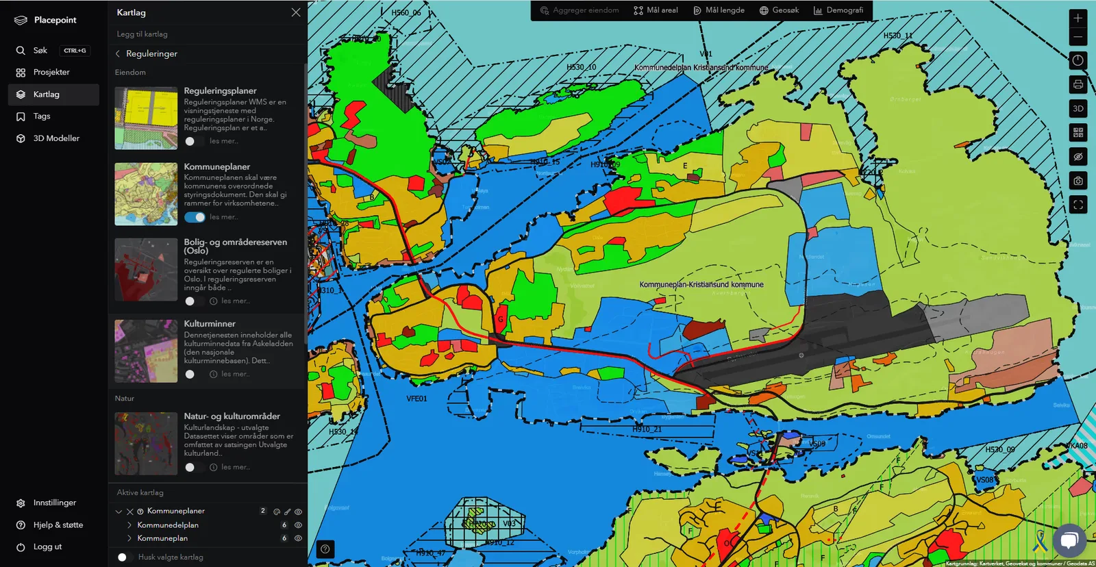
In this article you can read about how to read the zoning map that forms part of the land-use element of the municipal master plan (kommuneplanens arealdel). Which main categories there are, and how you read the zoning map in conjunction with the zoning provisions (reguleringsbestemmelsene).
Land-use purposes (arealformål)
The zoning map shows which areas are to be used for what. The different colours mark different types of main categories for land use:
- Buildings and installations
- Community facilities
- Green structures/technical infrastructure
- Defence
- Agriculture/nature/outdoor recreation areas
- Use/protection of sea/watercourses
These main categories can in turn be divided into sub-purposes. You can also see markings showing which areas are zoned above and below ground level, and zones with restrictions that affect what the area can be used for. The latter are called consideration zones (hensynssoner) and indicate which considerations must be taken into account.
All the map legends are found on the left-hand side of the map. If you find several maps of the same map section, it is because the area is zoned at ground level (vertical level 2 – e.g. roads, junctions, footpaths and cycle paths), below ground level (vertical level 1 – e.g. tunnels) and perhaps also above ground level (vertical level 3 – e.g. bridges).
When you read a zoning map, you must read it in conjunction with the associated zoning provisions. The zoning map is a legally binding document, which means that it cannot be changed without going through a new planning process.
The zoning provisions
The zoning provisions are legally binding and indicate which provisions apply to each individual area. Examples of zoning provisions are the utilisation ratio (utnyttelsesgrad) of plots, regulation of building heights and type of building. Along public roads and railways there are typical provisions relating to access points, building lines and limit values for air pollution and noise.
Read more
What is a zoning plan and what does it do?
The zoning plan controls what you can build and where. Learn about the plan map, provisions, planning description and area purpose, and the difference between area zoning and detailed zoning. A complete guide.
Planning and zoningMunicipality plan and zoning plan: which applies where?
What is the difference between a municipality plan and a zoning plan? We explain what you need to take into account.
Planning and zoningWhat does a municipality plan contain?
A municipality plan governs land use and development. Get a full overview of what the plan contains.