









Cadastre (matrikkelen)
Matrikkelen (the cadastre) is Norway's official register of properties, buildings and addresses. Learn what it contains, who uses it and how to find cadastral data for a property in Placepoint.
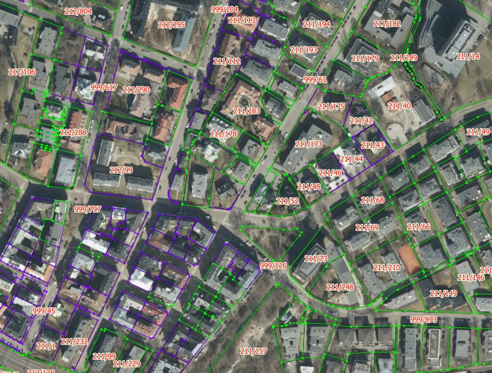
Matrikkelen is Norway's official property register. In this article you will find information about what the cadastre contains, what the information is used for and who uses the cadastre.
Matrikkelen is Norway's official property register. It contains information on property boundaries, buildings, dwellings, addresses and area.
Every property is identified by a specific number, known as the cadastral number (matrikkelnummer). This number consists of the municipality number, farm number (gårdsnummer), holding number (bruksnummer) and, where applicable, leasehold number (festenummer) and/or section number (seksjonsnummer). To find your property in Placepoint, you can search by cadastral number or address, and to show the cadastral boundaries you can add the cadastre map layer.
Matrikkellova (the Cadastre Act) and its regulations set out the rules for keeping the cadastre. Kartverket is the central cadastral authority and is responsible for operating and managing the cadastre. The local cadastral authorities are the municipalities, and they are responsible for carrying out cadastral surveys (oppmålingsforretninger) and entering most of the information in the cadastre. Information on registered rights in the property does not appear in the cadastre - but in the Land Registry (grunnboken).
What is the information in the cadastre used for?
- Applications for subdivision, building applications and zoning under the Planning and Building Act (plan- og bygningsloven).
- Property tax
- Property development
- Calculation of agricultural subsidies
- Presentation of evidence in the courts
- Calculation of compensation on expropriation
- Addresses for postal and courier services
- Helping the emergency services find their way on call-outs
Who uses the cadastre?
- The emergency services
- Municipalities
- The land registration authority (tinglysningsmyndigheten)
- Norges Bank
- NAV
- Statistisk sentralbyrå
- Agricultural authorities
- Statens vegvesen
- Insurance companies
- Skatteetaten
- Brønnøysundregistrene
- Navigation services
- Construction machinery
Boundaries in the cadastre
The boundaries in the cadastre are mapped with coordinates. Since 1990, boundaries have mainly been surveyed using modern measurement technology, which ensures good accuracy. Older boundaries may vary in accuracy and can be out by several metres. In built-up areas, boundaries are often more accurate than in sparsely populated areas. The surveyed property boundaries should, as a rule, be marked on the ground with officially approved boundary markers.
The cadastre uses colour codes that indicate how accurate the registered boundaries are. The green boundaries are the most accurate, becoming less and less accurate towards red, which denotes sketch-level accuracy. Where a property is marked with a dashed line, no boundaries exist in the map.
Read more
Abbreviations for home and plot area
Confused by BRA, BTA, BOA and P-ROM? Here is an overview of the most common area abbreviations.
Property developmentPhases of property development
An overview of every phase of a property development project, from concept to completion.
RegistersLand Registry (grunnboken)
Grunnboken (the Land Registry) is Norway's register of property rights. Learn what it contains and how to read it.